Uzbekistan
Surxondaryo Region, Uzbekistan — Towns & Travel Guide


Surxondaryo Region fills Uzbekistan's hot southern corner, where the Surxondaryo river runs down to the Amu Darya at Termez.
About Surxondaryo Region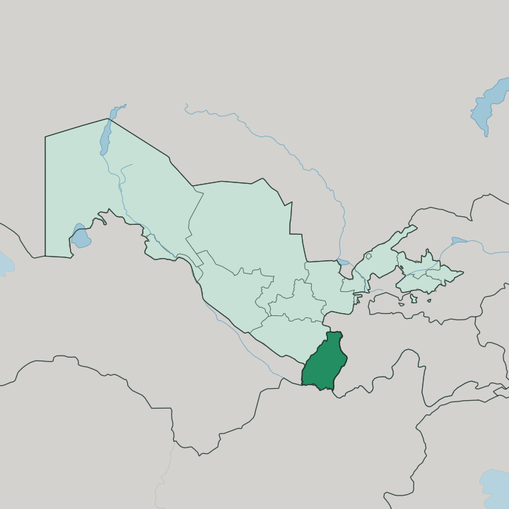
Towns & cities in Surxondaryo Region
Pick a town or city — each links to where to stay.
Termez is the obvious base. The capital keeps the region's hotels, the airport, and the ruins of the old Buddhist monasteries, and it faces Afghanistan across the Amu Darya. Boysun sits up in the hills to the north, a smaller town known for the folk traditions UNESCO singled out and the spring festival that fills it once a year.
Denov lies further north again, near where two mountain streams join to make the Surxondaryo river, on the way to the Tajikistan border. Choose Termez for the ancient sites; head to Boysun or Denov when you want the mountains and the villages instead.
About Surxondaryo Region
This is Bactria.
What is Surxondaryo Region known for?
The land around Termez held some of Central Asia's earliest Buddhist monasteries, and monks from here carried the doctrine east toward China and Tibet. Termez itself sits on the Amu Darya and runs Central Asia's only river port, looking across the water at Afghanistan. The mountains that wall off the north, the Gissar Range chief among them, block the cold and leave Surxondaryo the warmest place in the country.
Cotton, orchards, and vineyards fill the irrigated lowlands below them.
Where is Surxondaryo Region?
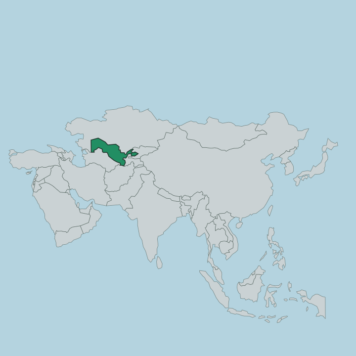
Surxondaryo occupies the extreme south-east of Uzbekistan, the country's deepest reach toward the mountains of Central Asia. It borders three foreign states. Turkmenistan lies to the west, Afghanistan to the south across the Amu Darya, and Tajikistan to the north-east, while the Qashqadaryo Region is its only neighbour inside Uzbekistan. High ground frames it on almost every side.
The Gissar Range and its spurs, the Baysuntau and the Kugitangtau, close off the north and west, and the Babatag ridge runs down the eastern edge. Khazrati Sulton peak crowns the Gissar wall, and at well over four thousand metres it is the highest point in the whole of Uzbekistan. Between the ranges the land drops toward the Amu Darya valley in the south.
The region draws its name from the Surxondaryo, the river that gathers in the north and runs the length of the lowland. It forms near Denov where the Karatag and the Toʻpolondaryo meet, then flows south for some 175 kilometres and empties into the Amu Darya at Termez. Along that river the irrigated fields run.
The mountains hold the cold at bay, and so this corner turns hotter and drier than anywhere else in the country.
What is Surxondaryo Region like?
Most of Surxondaryo lives on the land, in villages strung along the river and up in the mountain valleys, and the old ways have held on here more stubbornly than in the cities of the north. Uzbeks make up the large majority. A sizeable Tajik minority shares the valleys, a legacy of the region once belonging to the Bactrian world rather than the Sogdian one over the Gissar wall.
Nowhere shows that persistence better than Boysun. Cut off for centuries as the Silk Road faded, the town kept alive a layered mix of shamanic, Zoroastrian, Buddhist, and Islamic practice, and in 2001 UNESCO named the cultural space of Boysun District a Masterpiece of the Oral and Intangible Heritage of Humanity. The rituals there still mark the turning of the year.
On the eve of the Navruz spring festival, families hold a sowing rite with offerings of food, and weddings, births, and funerals carry customs far older than the mosque. Once a year the Boysun Bahori festival gathers singers, dancers, and horsemen while the hills are green, and song forms with names like alla and lapar are contested alongside wrestling and horse races. Handwork is rooted just as firmly in Surxondaryo.
Weaving and embroidery pass down at home in the valleys, learned young. This is a rural, traditional Uzbekistan, closer to its mountains than to its museums.
What is the history of Surxondaryo Region?
This was ancient Bactria. Termez grew up on the Amu Darya more than two thousand years ago, and under the Kushan kings it became a great Buddhist centre, its monasteries at Fayaz Tepe and Kara Tepe among the earliest in Central Asia. From here preachers carried Buddhism east into China and Tibet.
Later the faith gave way to Islam, and the Silk Road ran caravans through the valleys. The modern region is far younger: the Soviet authorities drew Surxondaryo as an administrative unit in 1941, folding this old Bactrian land into the map of Uzbekistan.
What is the climate of Surxondaryo Region?
Surxondaryo is the hot end of Uzbekistan. The Gissar Range and its spurs seal off the north, so the cold air that chills the rest of the country never reaches the valleys, and Termez routinely ranks as the hottest town in the land. Summers scorch the lowlands, with midsummer readings that have climbed near 49 degrees along the Amu Darya.
Winters stay mild and damp by Central Asian standards, and what little rain falls comes mostly in the cooler months. Spring is the season to come, when the Boysun hills turn green.
How do you get to Surxondaryo Region?
Termez is the way in. The regional capital has its own airport, and the flight down from Tashkent takes only a little over an hour across the country. Trains are the other option, mostly overnight services that run south from Tashkent to the Termez station and let you sleep through the long ride.
Once here, roads fan out from Termez up the valley to Denov and into the Boysun hills. The Amu Darya marks the southern limit, and beyond it lies Afghanistan.
Good for
Updated July 2026