Brazil
Amapá, Brazil — Towns & Travel Guide


Amapá sits in the far north of Brazil, where the Amazon empties into the Atlantic and the equator runs straight through its capital, Macapá.
About Amapá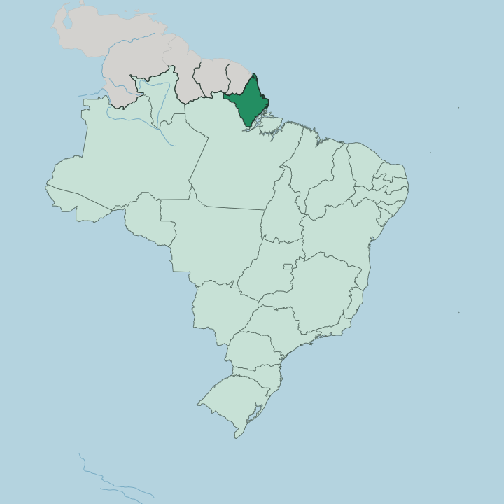
Towns & cities in Amapá
Pick a town or city — each links to where to stay.
Macapá is the obvious base, the capital and by far the largest city, with the fort, the riverfront and the equator monument all in easy reach. Almost every visitor starts there. Santana, its river port a short way southwest, is where Amazon boats tie up and where the ferries to Belém leave.
Oiapoque sits at the far northern end of the state, on the Oyapock River facing French Guiana, and it is the crossing point for anyone driving on to Cayenne. Laranjal do Jari, deep in the south near the Jari River, is the only other town of any size.
About Amapá
What is Amapá known for?
Amapá is the second-least populous of Brazil's 26 states, and rainforest covers most of it. The equator is the headline. It runs straight through Macapá, the capital, where the Marco Zero monument marks the line and the Zerão football stadium sits with its centre circle split between the two hemispheres.
Wilderness is the rest of the story, from the Tumucumaque mountains inland to the mangrove coast of Cabo Orange National Park. The Amazon River forms the state's southern edge before it reaches the sea.
Where is Amapá?
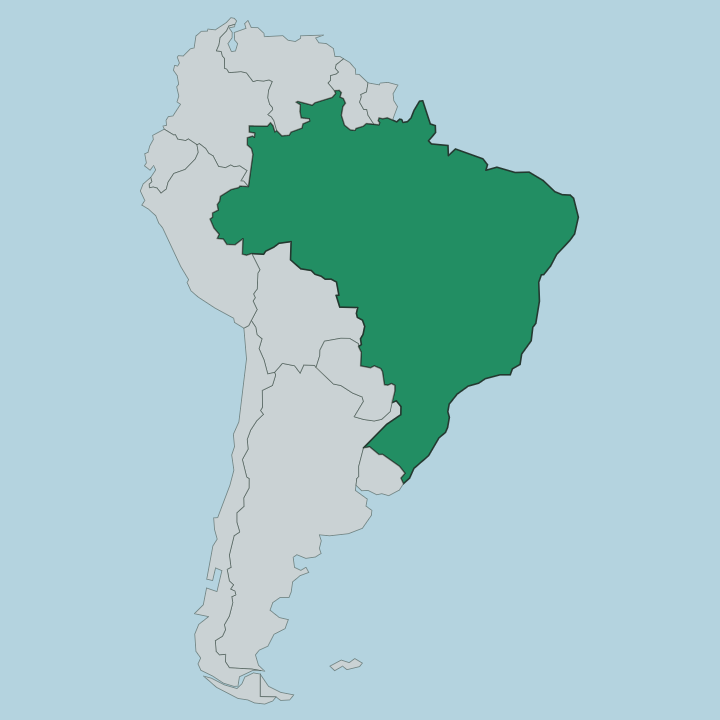
Amapá fills the far northern corner of Brazil, hard against the Guianas. Water and forest draw its every edge. The Oyapock River forms most of that northern border, dividing Amapá from French Guiana as it runs inland from the coast.
From the river's source the line climbs the Tumucumaque watershed to the west, and the whole French Guiana frontier runs more than 700 km, with a short reach in the northwest that meets Suriname. Its eastern side is all Atlantic Ocean. To the south and west lies Pará, with the northern channel of the Amazon River marking much of that boundary.
The equator itself passes through Macapá, the capital, where the river finally reaches the sea. Inland, the country rises into unbroken rainforest. Amapá is among the most heavily forested states in Brazil, with woodland over the great majority of its area.
The Tumucumaque mountains lift the land along the borders with Pará and French Guiana, and the enormous Tumucumaque National Park shields that interior. Toward the sea the forest breaks into flooded savanna, mangrove and swamp, the wetlands that Cabo Orange National Park keeps on the coast facing French Guiana. Rivers do the work that roads do elsewhere.
The Araguari, the Jari and a web of smaller channels carry the rain down to the Atlantic. Little of it has ever been cleared.
What is Amapá like?
Life in Amapá gathers along the rivers and the coast, where nearly everyone lives, while the forested interior stays all but empty. Macapá sets the tone. Its signature tradition is marabaixo, an Afro-Brazilian music and dance carried down from enslaved Africans, driven by hand-beaten drums called caixas and washed down with a fermented ginger drink.
Quilombo communities founded by escaped slaves still ring the capital, and the village of Curiaú keeps those customs alive just outside the city. Portuguese is the everyday language. The interior tells a different story.
Indigenous peoples hold large protected lands along the northern and western borders, among them the Wajãpi, whose graphic art was recognised by UNESCO. Near Oiapoque, the Karipuna, Galibi-Marworno and Palikur peoples live within reach of the French border, and Creole and French mix into daily speech in a way found nowhere else in Brazil. Açaí, cut from the palms of the floodplain, has been an everyday food here for generations, long before it became fashionable abroad.
This is a frontier state. It feels closer to the Guianas and the Caribbean than to the big cities of the south.
What is the history of Amapá?
Amapá's history is a long argument over a border. Portugal built the great star-shaped Fortaleza de São José de Macapá from 1764 to hold the north bank of the Amazon against the French in Guiana. The claim was contested for generations. France and Brazil both wanted the land between the Amazon and the Oyapock, and the quarrel, known as the Amapá Question, went to international arbitration and was settled in Brazil's favour in 1900. For decades afterwards it was a remote federal territory.
Amapá became a state of Brazil in its own right in 1988.
What is the climate of Amapá?
Amapá sits on the equator, so it is hot and humid the year round, with little change in temperature from one month to the next. The seasons are marked by rain, not by cold. A long wet season runs from about January into June, when downpours flood the rivers and soak the forest, and a drier, brighter spell follows through the second half of the year.
The Atlantic brings steady trade winds onto the coast. Rain, heat and green are the constants.
How do you get to Amapá?
Amapá is one of the hardest states in Brazil to reach by land. No road connects it to the rest of the country, because the island of Marajó and the mouth of the Amazon cut it off from Belém and everywhere south. Air is the simplest way in.
Macapá International Airport handles the flights, most of them routed through Belém or Brasília. The other way is the river, a slow riverboat passage up the Amazon that ties up at the port of Santana. From Macapá the BR-156 highway runs north to Oiapoque, where the Franco-Brazilian bridge crosses the Oyapock into French Guiana.
Good for
Updated July 2026