Brazil
Mato Grosso do Sul, Brazil — Towns & Travel Guide


Mato Grosso do Sul is the Pantanal wetland state of west-central Brazil, from flooded plains and cerrado to the clear diving rivers of Bonito.
About Mato Grosso do Sul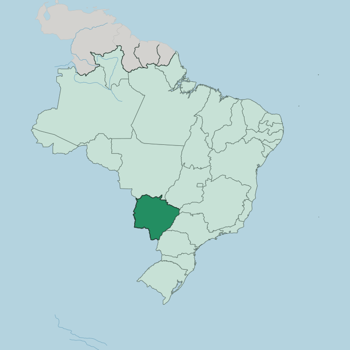
Towns & cities in Mato Grosso do Sul
Pick a town or city — each links to where to stay.
Base yourself by what you came to see. Campo Grande, the capital, holds the main airport and the bus lines that fan out across the state, which makes it the practical first night for almost every itinerary. Bonito is the base for the clear rivers.
For the Pantanal, the ranch lodges near Corumbá and the town of Miranda put travellers out on the seasonally flooded plain itself. Past the paved highways, beds grow scarce and the distances long.
About Mato Grosso do Sul
What is Mato Grosso do Sul known for?
Two things put Mato Grosso do Sul on the map: the Pantanal and Bonito. The Pantanal is the world's largest tropical wetland, a seasonally flooded plain shared with Bolivia and Paraguay where jaguars, caiman and hyacinth macaws gather in numbers rare elsewhere in South America. Bonito sits in the Serra da Bodoquena hills and draws snorkellers to spring-fed rivers so clear the fish seem to float in place.
Beyond them lie the cerrado and the cattle country. Campo Grande anchors it all.
Where is Mato Grosso do Sul?
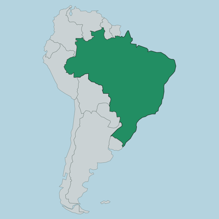
Mato Grosso do Sul fills the southern part of Brazil's Central-West, roughly the size of Germany, and it touches more borders than almost any other Brazilian state. Five states ring it. Mato Grosso lies to the north, with Goiás and Minas Gerais to the north-east, São Paulo to the east, and Paraná to the south-east.
Two countries close the western side: Paraguay and Bolivia. The land is defined by water and by the divide between two great basins. In the west and along the Bolivian and Paraguayan edge spreads the Pantanal, the enormous seasonally flooded plain that the Paraguay River drains as it runs south toward the Río de la Plata.
The eastern boundary follows the Paraná River, the other giant of the system. Between the two lies higher, drier ground. The cerrado savanna covers much of the centre and east, a mosaic of open grassland and gallery forest.
In the south-west the Serra da Bodoquena rises, a limestone range whose underground rivers surface as the crystal springs of Bonito. Campo Grande, the capital, stands on this higher country near the headwaters of the Anhanduí, in the Maracaju hills. Rivers, not mountains, set the rhythm here.
When the summer rains come, the Pantanal swells into a shallow inland sea, and the dry months draw it back to a maze of channels and lagoons.
What is Mato Grosso do Sul like?
Mato Grosso do Sul is a border culture, and its everyday habits come from three directions at once. The official language is Portuguese. From Paraguay, just across the western line, come tereré, the cold yerba-mate drink passed around in the heat, and chipa, the cassava-and-cheese bread with Guaraní roots.
Sopa paraguaya, a dense corn cake, turns up at the same tables. The Pantanal adds its cowboy side. Cattle here still move on horseback in comitivas, the long drives that push herds to higher ground when the floods rise, and that ranch life feeds a music of viola and the swung rhythm of the rasqueado.
Campo Grande carries a third strand. The capital took in one of Brazil's largest Okinawan communities in the early twentieth century, and their kitchens gave the city sobá, a wheat-noodle soup sold in the central market and honoured with its own festival. Older still are the Guaraní-Kaiowá and the Terena, whose reserves lie thick around Dourados in the south, and whose words and foods sit under the whole regional table.
German, Italian and Middle Eastern families settled in too. The mix is the identity.
What is the history of Mato Grosso do Sul?
The land was opened by gold. Paulista bandeirantes pushed west from São Paulo in the early eighteenth century chasing the placer mines, and when the gold thinned the cattle ranches that still define the state took their place. The Paraguayan War tore through the west in the 1860s, when invading forces seized Corumbá on the river.
Statehood came late. Mato Grosso do Sul was carved from the southern half of Mato Grosso in 1977 and took full effect at the start of 1979, inheriting the older state's name, which means the southern thick bush.
What is the climate of Mato Grosso do Sul?
Two seasons, wet and dry, run the year. The summer rains fall from spring into early autumn, and they are what floods the Pantanal, spilling the Paraguay River across the plain until it becomes a shallow inland sea. Winters are dry and warm.
The cerrado browns off, the floodwaters pull back, and the heat can be fierce away from the rivers.
How do you get to Mato Grosso do Sul?
Campo Grande holds the main airport. Its international airport takes the domestic flights from São Paulo that most visitors change onto, and from there the highways BR-163 and BR-262 fan out to the rest of the state. Bonito lies about 300 kilometres south-west, some five hours by road or a short hop to its regional airstrip.
Corumbá anchors the far west. From there the road and the old rail line reach the Bolivian border, while the Paraguay River carries barge traffic down toward the south.
Good for
Updated July 2026