China
Inner Mongolia Autonomous Region, China — Towns & Travel Guide


Inner Mongolia is China's northern grassland region, a vast plateau of prairie and desert arcing along the Mongolian border.
About Inner Mongolia Autonomous Region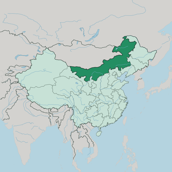
Towns & cities in Inner Mongolia Autonomous Region
Pick a town or city — each links to where to stay.
Hohhot is where almost every trip starts, the capital and the point the bullet train from Beijing reaches in about two and a half hours. The choice is grass or sand. North of the city lie the Xilamuren and Xilingol prairies, where tourist ger camps swap a hotel room for a felt tent, a welcome ceremony, and rides on horse and camel.
West toward Ordos the land turns to the Kubuqi sands and the Mausoleum of Genghis Khan above the Yellow River loop. Far to the north-east, Hulunbuir holds the greenest steppe of all. Choose Hohhot to arrive, a grassland camp to sleep under the open sky, and Ordos for the desert and the Khan.
About Inner Mongolia Autonomous Region
Grassland is the signature.
What is Inner Mongolia Autonomous Region known for?
Inner Mongolia is China's great pastoral region, and the open prairie of Hulunbuir and Xilingol carries the image of Mongol horsemen, felt tents, and grazing herds that draws most travellers north. The Gobi Desert bites into the west and the Yellow River loops through the loess in the south, so the same region holds both sand and steppe. Ordos guards the Mausoleum of Genghis Khan.
Hohhot, the capital, is where nearly every trip begins.
Where is Inner Mongolia Autonomous Region?
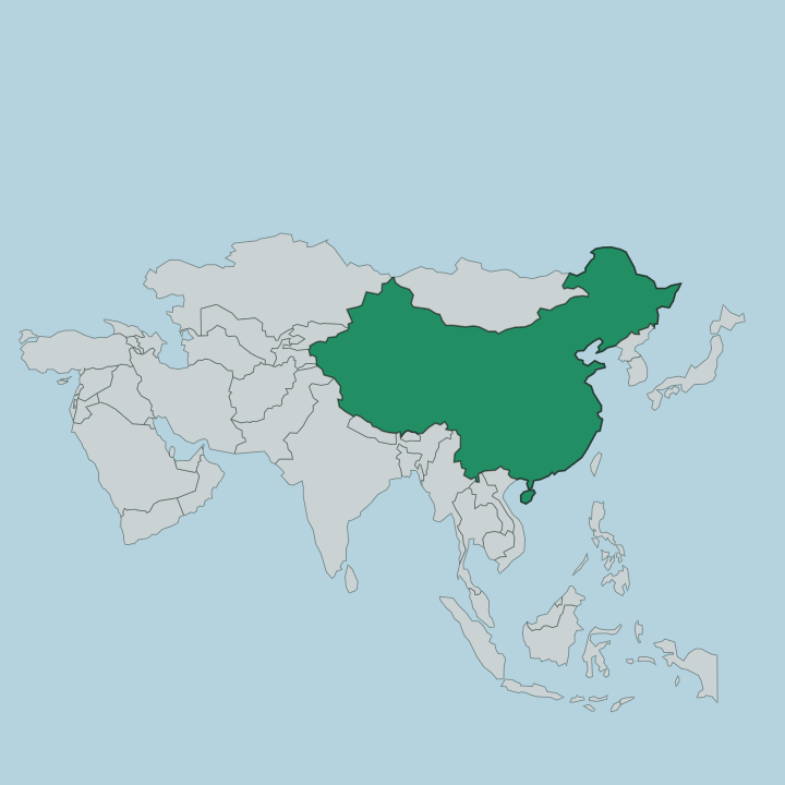
Inner Mongolia is a long band of northern China that arcs for some 2,400 kilometres along the border with the country of Mongolia. It is the third largest of China's regions by area. Most of it is a high plateau, averaging around 1,200 metres above the sea, carpeted in loess and windblown sand and, across the east, in open grass.
The prairie is the dominant feature. Grassland runs from the Hulunbuir plateau in the far north-east, west of the Greater Khingan forests, down through the central Xilingol steppe. To the west the grass thins and gives way to the Gobi Desert, the cold sixth-largest desert on earth, shared with the country of Mongolia to the north.
The Yellow River enters from the neighbouring provinces to the south, swings north around the Ordos plateau in a great loop, and lays down the fertile loess where most of the region's people live. The Greater Khingan range walls off the wetter, forested north-east, its slopes carrying Mongolian oak, birch, and pine. So the region divides three ways.
Forest and mountain lie in the north-east, open steppe fills the centre, and desert holds the arid west. Beyond the northern edge lie Mongolia and, further out, Russia. That frontier position, buffering the Chinese heartland from the steppe, has shaped the region for centuries.
What is Inner Mongolia Autonomous Region like?
The grassland is not only scenery here; it is the root of the culture. Mongol herding life gave the region its enduring images, and the felt ger, the mounted herdsman, and the great summer gatherings still frame how the steppe is pictured from within and without. The Naadam festival brings the three manly games.
Wrestling, horse racing, and archery draw crowds onto the open prairie in the warm months, alongside the long, held notes of Mongolian throat singing and the sweep of costumed dance. The Mongolian language is spoken across the region in dialects such as Chakhar, Khorchin, and the Xilingol tongue, written in the old upright script that runs down the page, and it stands beside Mandarin on the region's signs and schools. Faith left its mark on the land.
Tibetan Buddhist monasteries dot the older towns, and out on the grass the aobao, a piled cairn of stones, marks a place of worship where travellers add a rock and circle it. Food follows the herds. Mutton, dairy, and milk tea anchor the table, and the roasted-lamb Zhama banquet is the set-piece meal of a grassland camp.
Genghis Khan is honoured above all. His cenotaph at Ordos is the focus of solemn sacrificial rites held four times a year on the days of the lunar calendar, and his name carries a weight here that no other does. It is a culture of the open range, not the walled city.
What is the history of Inner Mongolia Autonomous Region?
This is old Mongol ground. Genghis Khan forged the Mongol Empire out of these steppes in the early thirteenth century, and his grandson Kublai Khan went on to rule all of China as the Yuan dynasty from 1271. For centuries the grassland stood as the frontier between the settled Chinese south and the nomads of the open north, a buffer fought over by empires.
The autonomous region itself was drawn up in 1947, the first of its kind in the People's Republic, stitched together from the old provinces of Suiyuan, Chahar, and their neighbours. The Khan's name still crowns the land at Ordos.
What is the climate of Inner Mongolia Autonomous Region?
The climate is harsh and continental. Winters on the plateau are long, dry, and bitterly cold, with January often sitting well below freezing across the grassland, while the short summer turns warm and green as the rain arrives in July and August. Spring comes windy and abrupt, and autumn brings an early frost.
The Gobi west stays arid year round, and rainfall is thin everywhere, gathered into those two summer months. The prairie is green and mild only briefly. Come between June and September, when the grass runs and the days are warm.
How do you get to Inner Mongolia Autonomous Region?
Most travellers come through Hohhot. A high-speed train from Beijing reaches the capital in about two and a half hours across roughly 484 kilometres, and Hohhot's Baita International Airport is the region's main air hub, linking it to Beijing, Shanghai, and cities across China. From Hohhot the road runs west to Baotou and Ordos, past grassland and the Yellow River loop, while the northern grasslands of Hulunbuir are far enough to fly.
The region stretches a very long way. Trains and roads knit its scattered cities together, but distances between them are large.
Good for
Updated July 2026