China
Jilin, China — Towns & Travel Guide


Jilin fills the middle of Northeast China, from the Changbai Mountains in the east to the corn plains of the west.
Find your area →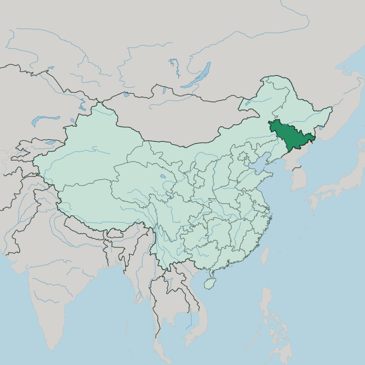
Towns & cities in Jilin
Pick a town or city — each links to where to stay.
 China
China
Changchun
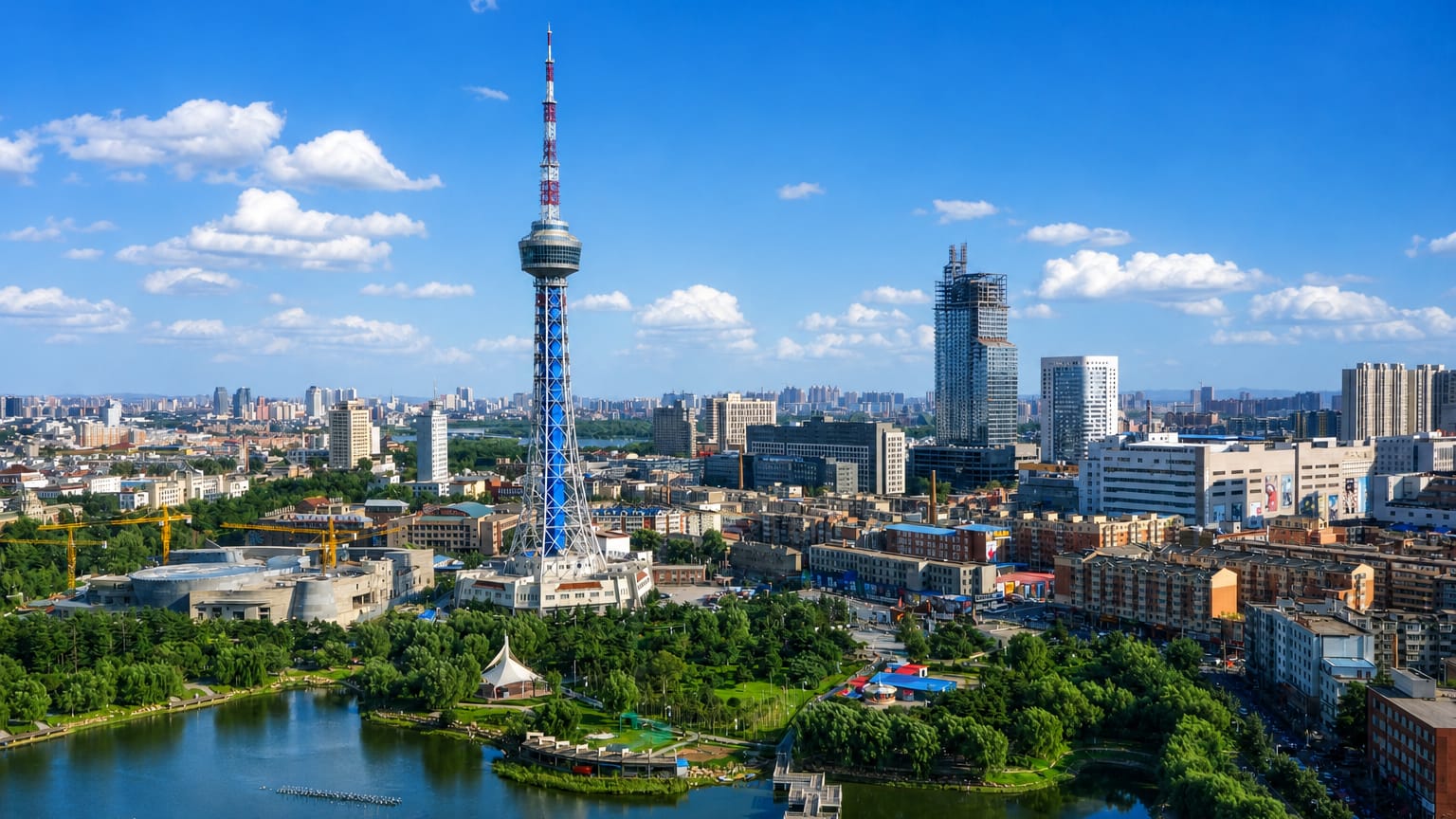
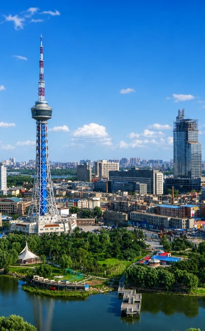
Broad avenues cross Changchun, the capital of Jilin Province on the Songliao Plain, known for its film studio and China's automotive industry.Where to stay →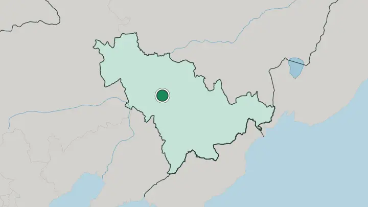
About Jilin
What is Jilin known for?
Jilin is the central of the three provinces that make up Northeast China, the region long called Manchuria. Winter defines it. Along the Songhua River at Jilin City, freezing fog coats every willow and pine in white frost, a phenomenon called wusong that locals count among the Four Great Natural Wonders of China.
To the east rise the Changbai Mountains, and in their highest crater sits Heaven Lake. Changchun, the capital and largest city, built the country's first cars and its earliest film studio.
Where is Jilin?
Jilin forms the central part of Northeast China, the region once known as Manchuria. It is landlocked, hemmed in by neighbours on every side. Heilongjiang lies to the north, Russia's Primorsky Krai to the east, North Korea to the south, and Liaoning with Inner Mongolia to the west. The province tilts from high ground in the east down to open plain in the west.
That tilt divides the land into three. The eastern edge belongs to the Changbai Mountains, a volcanic range shared with North Korea, whose highest summit cradles Heaven Lake in an old crater. From those slopes pour the three great rivers of the region, the Songhua, the Tumen, and the Yalu.
The Songhua swings north and west through the province, curling past Jilin City before it leaves for Heilongjiang. West of the mountains the ground flattens into the Northeast China Plain, a sweep of black soil that grows some of the country's heaviest corn harvests. Between the peaks and the flatland runs a belt of rolling hills.
Rivers made this place. The Manchu even named it for one, from a phrase meaning along the river.
What is Jilin like?
Jilin wears its many peoples openly. Han Chinese make up most of the province, but the east tells another story. In the Yanbian Korean Autonomous Prefecture, along the Tumen River frontier with North Korea, street signs carry Chinese and Korean side by side, and the ethnic Koreans known as Chaoxianzu keep their own schools, food, and song.
The Changbai Mountains themselves are woven into Manchu identity, held as the ancestral homeland of the dynasty that ruled the last empire of China. Modern culture here grew out of industry. Changchun earned the name cradle of Chinese cinema, home to the studio that turned out the young republic's first films, and its factories rolled out the nation's earliest home-built cars.
Cold shapes daily life as much as heritage does. Winter is the great season, when the rime frost draws crowds to the Songhua River and skiers to the eastern slopes. Ginseng grown wild in the forests scents the local cooking and medicine.
It is a border province, and it feels like one, pulled between China, Korea, and the old Manchu past.
What is the history of Jilin?
The Manchu named this land for its river, from girin ula, along the river. Under the Qing dynasty a military governor ruled it from the walled town that became Jilin City, and the throne long sealed the Changbai Mountains as sacred Manchu ground. Then war remade it.
In 1932 Japan carved the puppet state of Manchukuo out of the northeast and made Changchun its capital, renaming the city Xinjing, the new capital, until the war ended in 1945. What had been a frontier of governors became the seat of an occupied throne, and then a province of the People's Republic.
What is the climate of Jilin?
Jilin runs to extremes. Its temperate monsoon climate brings long, dry winters that bite hard under the Siberian high, then short summers that turn warm and wet. The two halves of the province feel it differently: the Changbai Mountains in the east stay cold and damp, while the western plains near Inner Mongolia run drier and a touch warmer.
Deep cold is the point in winter. That freezing air is exactly what glazes the willows along the Songhua River in rime frost. Rain falls mostly in the summer months, leaving the winter clear and hard.
How do you get to Jilin?
Most travellers reach Jilin through Changchun. The capital's Longjia airport handles the province's main flights, and a high-speed line links the city to Beijing in a few hours. Jilin City lies a short train hop east of the capital, close enough that many pair the two.
Reaching the Changbai Mountains takes more effort, by road or by the small airport near Heaven Lake, and the border east around Yanji is further still. Inside the province, fast trains and highways tie the western cities together, thinning out as the land climbs toward the eastern peaks.
Common questions
What is the best area to stay in Jilin?
Changchun: arriving and museum days in Jilin's capital.
Good for
Updated July 2026