China
Hēilóngjiāng, China — Towns & Travel Guide


Hēilóngjiāng is China's northernmost province, named for the Amur, the black dragon river tracing its long border with Russia.
Find your area →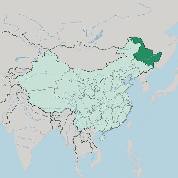
Towns & cities in Hēilóngjiāng
Pick a town or city — each links to where to stay.
 China
China
Harbin
Russian domes rise over Harbin, capital of Heilongjiang in northeast China, an Ice City known for its winter sculpture festival and St. Alexius Church.Where to stay →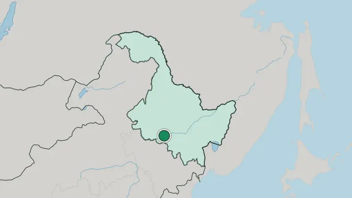
About Hēilóngjiāng
What is Hēilóngjiāng known for?
This is China's cold corner. Hēilóngjiāng is the country's northernmost and easternmost province, a frontier of black soil, birch forest and long river valleys pressed against Russia along the Amur. Winter is its calling card, and Harbin, the capital, turns the season into spectacle with a festival of carved ice blocks cut from the frozen Songhua.
Beyond the city lie the taiga of the Greater Khingan, the oil derricks of Daqing, and Mohe, the northernmost town in the country.
Where is Hēilóngjiāng?
Hēilóngjiāng fills the far north-east of China, the last province before Russia. Its whole northern and eastern edge is a river border. The Amur, which the Chinese call the black dragon river, runs along the top of the province, and the province takes its name straight from that water.
To the east the Amur meets the Ussuri, and at that confluence sits the easternmost point of the entire country. Jilin lies to the south and Inner Mongolia to the west, the two provinces that join Hēilóngjiāng to the rest of China. Inside those borders the land is mostly broad and low. The central plain of the Songhua and the Nen carries the black earth that makes this one of the great grain and soybean belts of the country.
Mountains frame the plain rather than fill it. The Greater Khingan range rises along the west and north-west, a long spine of taiga forest, while the Lesser Khingan crosses the province's northern reach. Up in that forested north stands Mohe, the northernmost town in China, close to where the Amur bends past the frontier.
Rivers order everything here. The Songhua, the Nen, the Mudan and the Ussuri all feed the Amur, and together they drain nearly the whole of this corner of Manchuria.
What is Hēilóngjiāng like?
Hēilóngjiāng wears its border on its sleeve. More than any other Chinese province, it has been shaped by Russia across the Amur, and nowhere shows this like Harbin. The capital grew up around the Chinese Eastern Railway at the turn of the twentieth century, and Russian engineers, traders and later refugees built a city of onion-domed churches, European facades and a cathedral of green-tiled towers.
That inheritance still flavours the food, the architecture and the street life of the old quarter. The province is also a homeland of the Manchu, who ruled all of China from Beijing, and of smaller northern peoples whose lives were tied to these forests and rivers. The Hèzhé of the eastern floodplains long fished the Amur and its tributaries, and hunting peoples ranged the taiga of the Greater Khingan.
Then there is the winter culture, unlike anywhere else in the country. Cold is not endured here so much as celebrated. Harbin's builders quarry clear blocks from the frozen Songhua and raise whole illuminated palaces of ice, and the deep-freeze season pulls travellers north for skating, sledding and the great ice festival.
What is the history of Hēilóngjiāng?
This was the outer edge of Manchuria. For centuries the homeland of the Manchu people, who founded the Qing dynasty and ruled all of China from Beijing, it stayed thinly settled forest and grassland watched over from a handful of garrison towns. Then the rails came.
Russia pushed the Chinese Eastern Railway through in the late nineteenth century, Harbin sprang up around the tracks, and waves of Han settlers followed the line onto the black-earth plain to farm the Songhua valley and later drill the oilfield at Daqing. The province in its present shape dates only to 1954.
What is the climate of Hēilóngjiāng?
Cold defines the calendar here. Hēilóngjiāng holds the lowest average temperatures of any Chinese province, with a bitter continental winter that locks the Songhua under thick ice from late autumn to spring and sends January well below freezing across the plain. The far north around Mohe, up in the Greater Khingan, is colder still and brushes the subarctic.
Summer flips the picture entirely, short and warm and green, when the black-earth fields turn to grain and the rivers run open again.
How do you get to Hēilóngjiāng?
Harbin is the way in. The capital's airport is the province's main gateway, with flights down to Beijing and the rest of China and high-speed trains running south through Jilin toward the coast. Most travellers reach Hēilóngjiāng this way, then branch out by rail across the province.
Onward lines climb north-west into the Greater Khingan and up to Mohe, and cross-border crossings along the Amur link the province to Russia. Once inside, trains and long roads stitch Harbin to Daqing and the frontier towns.
Good for
Updated July 2026