China
Qinghai, China — Towns & Travel Guide


Qinghai spreads across the northeastern Tibetan Plateau, a high province of China named for the great salt lake at its heart.
About Qinghai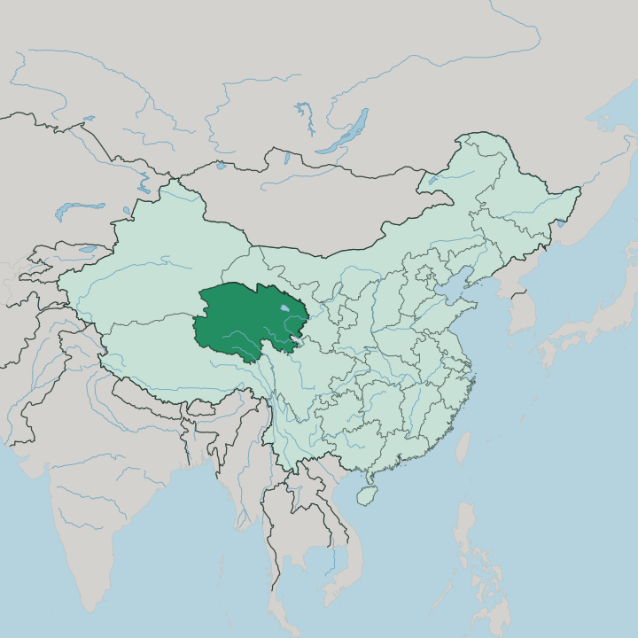
Towns & cities in Qinghai
Pick a town or city — each links to where to stay.
Xining is where almost every Qinghai trip begins. It is the only city on the Tibetan Plateau with more than a million people, and it holds the province's best hotels around the Chengzhong district downtown. From there the road climbs west to Qinghai Lake, where the Erlangjian and Heimahe shores keep simple guesthouses for anyone who wants a night beside the water and a plateau sunset spread wide over the salt sea.
Golmud is different. Far out in the western basin, it is a rough halfway halt on the railway toward Lhasa rather than a place to linger. Base yourself in Xining for comfort and connections; move out to the lake shore only when the plateau itself is the point.
About Qinghai
What is Qinghai known for?
Qinghai takes its name from Qinghai Lake, the largest salt lake in China, which the Mongols called Koko Nor and Tibetans call the blue sea. The province holds a rarer distinction. Deep in its southern grasslands, within a few hundred kilometres of one another, the Yellow River, the Yangtze, and the Mekong all begin.
That headwater country is the Sanjiangyuan, the Three-River Source. Xining, the capital, sits in the fertile east and serves as the base camp for almost every journey onto the plateau.
Where is Qinghai?
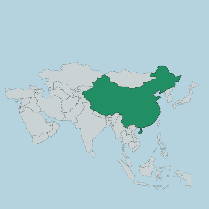
Qinghai fills the northeastern quarter of the Tibetan Plateau, in the far west of China. It is one of the country's largest provinces, and one of its emptiest. Gansu wraps around it to the north and east, Sichuan meets it in the southeast, the Tibet Autonomous Region borders the south and west, and Xinjiang runs along the northwest. Most of the land lies high.
The average elevation clears three thousand metres, and much of the province is a cold expanse of mountain, grassland, and salt basin rather than farmland or town. The terrain divides plainly. In the north the Qilian and Altun ranges wall off the province, while the Kunlun Mountains and their Bayan Har spur cut across the south-centre and mark the true edge of the plateau country.
Between and beyond them sits the Qaidam, a vast arid basin of salt flats and desert in the northwest. Qinghai Lake lies in the northeast, a shining saline sheet with no outlet to the sea. Nearly all of the population gathers in the eastern valleys around Xining, where the land drops low enough to farm.
The rest is thin air, long horizons, and grazing herds.
What is Qinghai like?
Qinghai carries the culture of Amdo, the historical Tibetan region whose old borders it roughly follows. The province is one of China's most mixed. Tibetan herders, Han settlers, Hui and Salar Muslims, Mongols, and Monguor farmers share the grasslands and river valleys, and for centuries their languages have borrowed from one another across the plateau.
Faith is worn openly here. Kumbum Monastery, founded in 1583 in the hills near Xining, is one of the great seats of Tibetan Buddhism and a pilgrimage goal famed for its butter sculptures, murals, and pile embroidery. The city itself tells the same layered story.
Xining's Dongguan Mosque draws Hui and Salar worshippers within sight of Buddhist prayer wheels, and the two traditions have coexisted along these valleys for generations. Out on the open range the year turns to a herder's calendar of horse festivals, wrestling, and long-distance pilgrimage. Butter tea, barley tsampa, and mutton anchor the plateau table.
Little of this culture is urban, and that is the point.
What is the history of Qinghai?
Long before it was a province, this high country was Amdo, the northeastern part of the Tibetan world, and the grazing land of the Mongol Qoshot khans who held Koko Nor. Xining guarded the frontier for successive Chinese dynasties, a walled garrison where the plateau met the empire. Statehood came late.
Qinghai became a province in its own right only in 1928, carved from territory that Gansu had long administered. Muslim warlords of the Ma clique ran it until the middle of the twentieth century. Its modern name simply means the blue lake at its centre.
What is the climate of Qinghai?
Altitude sets the terms here. Qinghai has cold winters, cool short summers, and a wide swing between the heat of the day and the chill of the night that comes with thin plateau air. Sunshine is long and the light is fierce, but rain is scarce, and the western Qaidam basin stays close to desert while the east around Xining catches more of the summer showers.
Xining escapes the worst of the cold thanks to its lower valley setting, mild enough in July that Chinese travellers have long called it a summer capital. Spring brings hard winds and dust off the dry western flats.
How do you get to Qinghai?
Almost everyone reaches Qinghai through Xining. The city's Caojiapu airport links it by air to Beijing, Xi'an, Chengdu, and Lhasa, and fast trains climb up from Lanzhou in Gansu in little more than an hour. Xining is also the eastern gate of the Qinghai-Tibet railway, the highest railway on earth, which runs across the plateau through Golmud on its way to Lhasa.
Beyond the rail corridor, road is the only way onward. From Xining, long highways strike out to Qinghai Lake and deeper into the grasslands.
Good for
Updated July 2026