Iran
Ilam Province, Iran — Towns & Travel Guide


Ilam Province is a Kurdish borderland in western Iran, where the central Zagros falls away toward the plains of Iraq.
About Ilam Province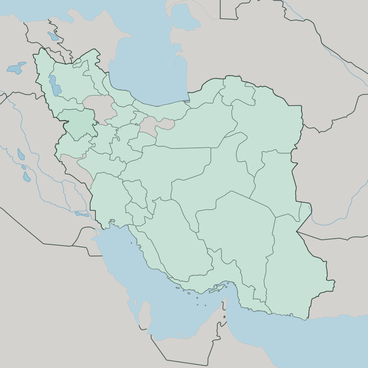
Towns & cities in Ilam Province
Pick a town or city — each links to where to stay.
Ilam city is the natural base, a hill town ringed by oak forest and the Sarab-e Ilam springs on the road up from Kermanshah. Most visitors go no further. Those who do split between the cool northern mountains and the hot southern plains.
Abdanan, in the south-east, opens onto the Mahuteh waterfall and the twin Siahgav lakes. Dehloran sits out on the low, baking flats near the Iraqi frontier, an oil town more than a resort. Mehran is a border crossing first and a place to sleep second, busiest when the Arbaeen pilgrimage floods the road to Karbala.
About Ilam Province
What is Ilam Province known for?
Two forces define Ilam: the wall of the Zagros and the road to Iraq. The oak-forested Kabir Kuh anticline runs the length of the province, its ridges earning Ilam the affectionate name the Bride of Zagros, a green exception in a mostly arid country. Mehran matters most.
Its border terminal funnels the Arbaeen pilgrimage toward Karbala, among the largest human gatherings anywhere on earth. Oil and gas fields lie beneath the southern plains. Wet, wooded, and thinly settled, this is one of Iran's least-travelled provinces.
Where is Ilam Province?
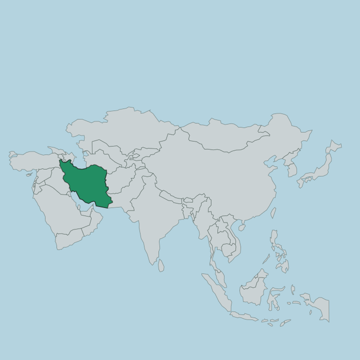
Ilam occupies the south-western corner of the Zagros, in the west of Iran, hard against the Iraqi frontier. That border runs some 425 kilometres, the longest stretch any Iranian province shares with Iraq. Kermanshah province lies to the north. Lorestan closes off the east, and Khuzestan the hot lowland south. Only one edge is not Iranian at all: the western one, where the last ridges of the Zagros give out onto the Mesopotamian plain and the checkpoints at Mehran and Dehloran open toward Baghdad.
The land splits cleanly in two. The north and east are mountain country, folded into long parallel anticlines of which Kabir Kuh is the greatest, a limestone wall running for roughly 160 kilometres above the valleys. Its flank was the source of the Seymareh landslide, among the largest rock avalanches known anywhere on the planet.
Rivers gather off these heights. The Seymareh traces much of the eastern boundary with Lorestan before merging downstream into the Karkheh, one of the longest rivers in Iran. West and south of the ridges the country falls away into warm, open plains that bake through the summer.
Ilam city sits up in the folds, cool and wooded; Mehran and Dehloran lie down on the flats. Between mountain and plain, the province holds two climates at once.
What is Ilam Province like?
Ilam is Kurdish country, and specifically Feyli Kurdish. The Feyli tribes, Kalhor, Malekshahi, Arkawazi and others, have grazed these ridges for generations, and their Southern Kurdish speech, in dialects such as Kalhori and Laki, fills the bazaars of Ilam and Mehran. It is not the whole picture.
Lak and Lur communities shade into the Kurdish majority along the eastern valleys, while Arabic-speakers cluster on the southern plains toward Khuzestan. Shia Islam binds them, which is why the Arbaeen march to Karbala matters so deeply here. Life here was long pastoral, tuned to the seasons of the high pastures and the oak woods that give the province its green name.
That heritage survives in the crafts. Women weave gelim flatweaves and knot rugs in dyes drawn from the mountains, and the reedy sound of the sorna and dohol carries the region's dances at weddings. Food leans on what the uplands give: dairy from the flocks, wild herbs, and flatbread.
Life in Ilam moves slowly, one of Iran's least urbanised and least industrial provinces, still tuned to the pasture and the tribe. Ilam remains one of the least urbanised, least industrial provinces in Iran, and its culture is still closer to the pasture and the tribe than to the city.
What is the history of Ilam Province?
The province wears an ancient name. Elam was one of the earliest civilizations of the Near East, rising on the lowlands and highlands of the southwest with its heart at Susa, and Ilam sat on its northern march. For much of the modern era the mountainous west of the province was known as Poshtkuh, the land behind Kabir Kuh, ruled semi-independently by the Feyli valis from the town of Hosseinabad.
That town was renamed Ilam under Reza Shah, and the old frontier country was folded into the Iranian state as the province it is now.
What is the climate of Ilam Province?
Elevation decides the weather. Up in the folds around Ilam city, winters are genuinely cold and snow closes the high passes, while the oak forests live on the rain and snowmelt the Zagros wrings from passing fronts. Drop west toward Mehran and Dehloran and the picture inverts: the plains turn ferociously hot and dry through a long summer, among the hottest ground in Iran.
The rhythm is broadly Mediterranean, mild wet winters, parched summers. All of which makes Ilam greener than most of the country.
How do you get to Ilam Province?
Ilam sits off Iran's railway map. Arrival means the road or the air, and most people take the road, climbing over the Zagros from Kermanshah, the nearest large city to the north, on the highway that runs on south to the Iraqi border. Ilam city keeps a small airport with flights to Tehran.
The other great portal faces outward rather than in: at Mehran the frontier opens toward Najaf and Karbala, and through the Arbaeen season the westbound pilgrim traffic is immense.
Good for
Updated July 2026