Japan
Aomori-ken, Japan — Towns & Travel Guide


Aomori-ken caps the northern tip of Honshu, an apple country of Nebuta lanterns, deep snow and two peninsulas cradling Mutsu Bay.
About Aomori-ken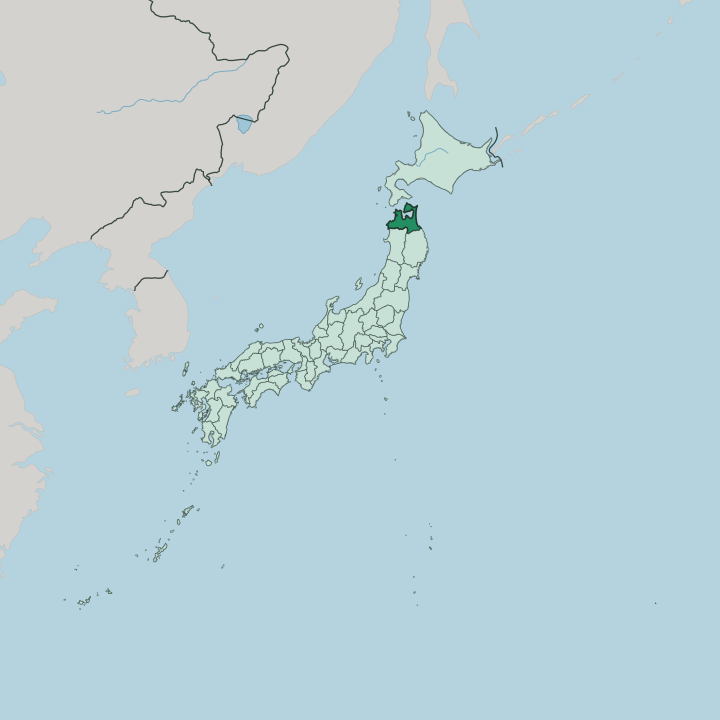


Towns & cities in Aomori-ken
Pick a town or city — each links to where to stay.
Aomori sits on Mutsu Bay, the obvious base for the Nebuta nights and the fish stalls of the Furukawa market. Hirosaki, the old Tsugaru capital inland, trades the coast for a moated castle and cherry orchards. For water and forest, head south to Lake Towada and the mossy Oirase gorge below it, where hot-spring inns stand among the beech trees.
Hachinohe faces the Pacific in the east, a working port of morning markets and tuna. The choice splits by side. The Tsugaru west and the Nanbu east keep different food, dialect and festivals.
About Aomori-ken
Apples made the name.
What is Aomori-ken known for?
Aomori grows more of them than anywhere else in Japan, and the orchards of the Tsugaru plain run right up to the slopes of Mount Iwaki. Every August the capital fills with the Nebuta Matsuri, when illuminated paper floats of warrior figures are hauled through the streets after dark. Hirosaki keeps its Edo-period castle and a spring flood of cherry blossom.
Inland lie the caldera waters of Lake Towada and the mossy Oirase gorge below it. Winter buries the Hakkōda Mountains under some of the heaviest snow in the country.
Where is Aomori-ken?
Aomori-ken caps the northern end of Honshu, the last prefecture before the sea gives way to Hokkaido. The Tsugaru Strait runs between the two islands, linking the Sea of Japan on the west with the Pacific Ocean on the east. Two peninsulas reach north from the mainland.
The Tsugaru Peninsula forms the western arm and the axe-headed Shimokita Peninsula the eastern one, and between them they enclose the near-landlocked waters of Mutsu Bay. Ōma, at the tip of Shimokita, is the northernmost point of the whole island of Honshu. Inland the land climbs fast. The Ōu Mountains, the long spine of northern Honshu, split the prefecture into the Tsugaru country in the west and the Nanbu country facing the Pacific in the east.
Mount Iwaki, the near-perfect cone the locals call Tsugaru Fuji, stands over the western plain and its apple fields. The Hakkōda Mountains rise behind the capital, and south of them the caldera of Lake Towada spills into the Oirase gorge on its way toward the Akita border. Further west, the trackless beech forest of Shirakami-Sanchi straddles the same border. Iwate lies to the south-east.
Water is never far in any direction.
What is Aomori-ken like?
Two cultures share one prefecture. The Tsugaru side in the west and the Nanbu side in the east were rival domains for centuries, and they still keep separate dialects, festivals and tempers. Summer belongs to the lantern floats.
Aomori hauls the towering Nebuta warriors through the streets, Hirosaki answers with the fan-shaped Neputa, and Goshogawara raises its Tachineputa floats several storeys high. The three-stringed Tsugaru-jamisen, hammered rather than plucked, grew out of the same western country as a music for travelling players. People settled here early.
At Sannai-Maruyama, on the edge of the capital, a Jōmon village of timber posts and pit dwellings stood for well over a thousand years, and it anchors a run of prehistoric sites listed by UNESCO. Faith took a stranger turn on the Shimokita Peninsula, where blind mediums known as itako are said to call up the dead among the sulphur vents of Mount Osore. Food carries the seasons here. Ōma sends prized bluefin tuna from the strait, Mutsu Bay yields scallops, and the Tsugaru orchards turn their apples into everything from juice to lacquer-dark pies.
The everyday language is Japanese, though the Tsugaru dialect can defeat visitors from the south. Locals wear that as a point of pride.
What is the history of Aomori-ken?
For most of its past this was the far northern edge of Mutsu Province, the frontier of the old Japanese state. Two samurai houses ruled it. The Tsugaru clan ruled the west from their castle at Hirosaki, while the Nanbu held the Pacific east.
The prefecture itself dates only to 1871, when the Meiji government swept the domains away. Its seat began at Hirosaki, then moved the same year to the harbour town of Aomori, chosen for its central position on the bay.
What is the climate of Aomori-ken?
Aomori-ken gets buried in winter. Cold air off Siberia picks up moisture over the Sea of Japan and dumps it as snow the moment it hits the Tsugaru coast, making the capital one of the snowiest lowland cities anywhere. The Ōu Mountains then split the weather in two.
The Tsugaru west lies under deep, wet snow, while the Nanbu east on the Pacific stays drier but colder in the wind. Summers arrive late and leave early. On the Hakkōda slopes the frozen firs stand as the 'snow monsters' that draw skiers.
How do you get to Aomori-ken?
Most visitors ride the rails north. The Tōhoku Shinkansen runs from Tokyo up the spine of Honshu, stopping at Hachinohe before it reaches Shin-Aomori near the capital. Some go further.
The line dives into the Seikan Tunnel beneath the Tsugaru Strait and carries on to Hokkaido as the Hokkaido Shinkansen. Aomori also has its own airport in the hills west of the city. Ferries still cross the strait to Hakodate, and the two peninsulas are reached by road.
Good for
Updated July 2026