Japan
Oita Prefecture, Japan — Towns & Travel Guide


Oita Prefecture fills the northeast of Kyushu, Japan's onsen country, where Beppu and Yufuin yield more hot-spring water than any other prefecture.
About Oita Prefecture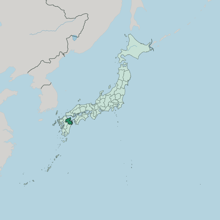


Towns & cities in Oita Prefecture
Pick a town or city — each links to where to stay.
Most visitors base themselves in the onsen towns. Beppu is the loud one, a seaside resort where whole neighbourhoods steam and the eight fields of the Beppu Hatto feed one bathhouse after another. Yufuin is its calm twin.
A walkable spa town of inns sits there between Lake Kinrin and the twin peaks of Mount Yufu. Oita, the capital, makes the practical hub, where the prefecture's fast train links gather and the old castle town of Funai still marks the centre. For temples over hot water, the Kunisaki Peninsula sets you among the Rokugo Manzan shrines.
Pick the coast for baths; pick the hills for quiet.
About Oita Prefecture
Oita is hot-spring country.
What is Oita Prefecture known for?
Beppu sits at the head of it, eight geothermal fields feeding public baths and the steaming, coloured pools known as the Hells of Beppu. Yufuin offers the quieter version, a spa town of ryokan under the twin cones of Mount Yufu. Inland rise the Kuju mountains, the roof of Kyushu, where the herds behind Bungo beef graze the high grassland.
The tart green kabosu citrus comes from here, and so do racks of dried shiitake. To the north, the Kunisaki Peninsula holds Usa Jingu and a scatter of cliff-carved Buddhas.
Where is Oita Prefecture?
Oita fills the northeast corner of Kyushu, the southwestern of Japan's main islands. Fukuoka Prefecture lies along its northwest, Kumamoto to the west, and Miyazaki to the south. Water frames the rest. The Seto Inland Sea washes the northern shore, and to the east the Bungo Strait separates Kyushu from the island of Shikoku across a narrowing gap.
Beppu Bay bites into the coast at the centre, and it is around this bay that the prefecture's towns cluster. The near-circular Kunisaki Peninsula bulges into the sea in the north, its radiating valleys climbing to Mount Futago at the hub. Most of Oita is upland.
Forest covers roughly seven-tenths of it, and the interior is a jumble of volcanic ranges. The Kuju mountains rise in the west as the roof of Kyushu, their highest summits capped with snow in winter, while Mount Sobo guards the rugged border with Miyazaki. Closer to the coast, Mount Tsurumi and Mount Yufu stand over Beppu and its steam.
The southern shore breaks into a ria coastline of deep inlets and headlands around the port of Saiki. Rivers drain the whole of it. The Ono and the Oita carry the mountain water down to Beppu Bay, and the land they cross gave the old province its name of the great fields.
What is Oita Prefecture like?
Life in Oita turns on hot water. Bathing is a daily ritual here, not a treat, and towns like Beppu route the steam into cooking pits where locals steam eggs and vegetables over the vents. The prefecture's kitchens lean on its own land: the sharp juice of the kabosu squeezed over grilled fish, dried shiitake from the oak forests, marbled Bungo beef, and the barley shochu poured after dark.
Toriten, a local battered chicken, turns up on menus everywhere. Faith runs deep and mingled. On the Kunisaki Peninsula the Rokugo Manzan tradition fused Buddhism with the older worship of the mountains, and its temples still ring Mount Futago.
Usa Jingu, the mother shrine of the Hachiman network that spread across the country, stands at the peninsula's foot. Stone speaks too. At Usuki, a set of cliff Buddhas carved into the tuff counts among the nation's designated treasures, while the Fuki-ji hall up on Kunisaki is the oldest wooden building on Kyushu.
Craft holds on in small workshops. The Onta potters still turn unsigned folk ware by waterwheel-driven hammers, and Beppu keeps Japan's most established bamboo weaving. The common tongue is Japanese, spoken here with a soft Bungo lilt.
What is the history of Oita Prefecture?
Two old provinces underlie Oita: Buzen in the north and Bungo in the south, once grouped together as Toyo. Power gathered early at Usa Jingu. By the 8th century the shrine had grown into a great landholding force at the head of the Hachiman cult.
From the Kamakura period the Otomo clan held Bungo, ruling the province for close to 400 years. Their most famous lord, Otomo Sorin, welcomed Portuguese ships and the missionary Francis Xavier to the port of Funai, opening this coast as one of Christianity's first doorways into Japan. The single prefecture was drawn in 1871, when the old feudal domains were dissolved.
What is the climate of Oita Prefecture?
Oita has a warm, humid climate. Summers on the coast run hot and sticky, and the rainy season of early summer soaks the whole prefecture before the typhoons of late summer arrive. Winters are mild by Japanese standards.
The Seto Inland Sea keeps the shore around Beppu Bay gentle, with light frost and little snow at sea level. Up in the Kuju mountains the story flips, and the high grassland turns cold enough to hold snow through the depths of winter.
How do you get to Oita Prefecture?
Most travellers come through Fukuoka. The Sonic limited express runs from Hakata to Kokura and then down the eastern shore of Kyushu on the Nippo Main Line, reaching Oita and Beppu in about two hours. Oita Airport sits out on the Kunisaki coast.
From there a rare hovercraft crosses Beppu Bay straight to the capital. For Yufuin, the Yufuin no Mori tourist train climbs inland on the Kyudai Line. Ferries fill in the sea routes, linking Beppu and Oita to the ports of Honshu and Saiki across to Shikoku.
Good for
Updated July 2026