Japan
Tokushima-ken, Japan — Towns & Travel Guide


Tokushima Prefecture fills the eastern end of Shikoku, from the Naruto Strait whirlpools to the gorges of the Yoshino River.
About Tokushima-ken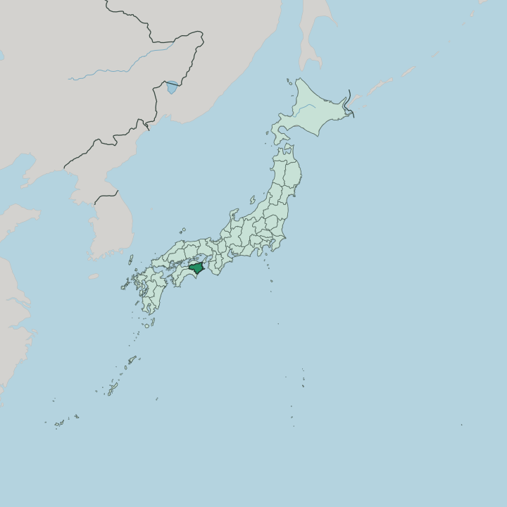


Towns & cities in Tokushima-ken
Pick a town or city — each links to where to stay.
The choice splits between coast and mountains. Tokushima, the capital at the mouth of the Yoshino River, makes the natural first base, closest to the Awa Odori and the airport. Naruto sits to the north beside its whirlpools.
Deep in the Shikoku Mountains, the Iya Valley rewards a night among the gorges and vine bridges, though beds there are few and scattered far apart. The southern Pacific Ocean coast around Hiwasa suits surfers and travellers after quiet shorelines rather than city streets.
About Tokushima-ken
What is Tokushima-ken known for?
Two things carry Tokushima Prefecture's name beyond Shikoku. The first is the Awa Odori, a Bon dance staged across Tokushima each August that draws crowds into the streets to the beat of drums, flutes, and shamisen. The second is water.
Off the northern coast the Naruto Strait spins some of the world's largest tidal whirlpools, funnelled between the Seto Inland Sea and the open Pacific Ocean beneath the span of the Ōnaruto Bridge. Inland, the Yoshino River fed the indigo trade that dyed the prefecture its famous Japan Blue.
Where is Tokushima-ken?
Tokushima Prefecture occupies the eastern corner of Shikoku, the smallest of the four main islands of Japan. It borders all three of the island's other prefectures: Kagawa to the north, Ehime to the west, and Kōchi to the southwest. The rest is sea.
The Seto Inland Sea washes the north-east, the narrow Kii Channel separates the prefecture from the Kii Peninsula across the water, and the open Pacific Ocean rolls against the long southern shore. At the northern tip the Naruto Strait pinches to a bottleneck between Shikoku and Awaji Island, and its tides breed the whirlpools the region is known for. Mountains fill most of the interior.
The Shikoku range climbs through the south to Mount Tsurugi, the highest summit in the prefecture and the second-highest on the whole island, while the lower Sanuki hills wall off the north. Between them runs the Yoshino River, the prefecture's spine, which gathers in distant Kōchi, carves the Ōboke gorge, then spreads across a broad alluvial plain to reach the sea at Tokushima. Its side valleys hide some of the most isolated settlements in the country.
Deepest of these is the Iya Valley, a cleft of steep forest and vine bridges buried in the Shikoku Mountains. Little flat land remains.
What is Tokushima-ken like?
Culture here turns on dance and dye. For more than four centuries the Awa Odori has filled Tokushima every summer, its troupes shuffling through the streets to a lopsided two-beat while onlookers are teased that the dancing fools and the watching fools may as well all dance. The festival grew wealthy on indigo.
Merchants along the Yoshino River made fortunes from aizome, the deep blue plant dye that foreign visitors of the Meiji era christened Japan Blue, and they poured that money into ever more elaborate processions. Fields of the indigo plant still feed a handful of master dyers. The colour remains the prefecture's signature.
Faith leaves its mark too. Tokushima holds the first twenty-three temples of the Shikoku Pilgrimage, so white-clad henro begin their thousand-kilometre circuit of the island here, at Ryōzenji near the Naruto coast. The mountains keep older stories.
Legend has it that defeated Heike warriors fled into the Iya Valley in the twelfth century and strung the first vine bridges to cut their tracks behind them. Food is plain and local: buckwheat soba in the highlands, sudachi citrus squeezed over almost everything, and the sweet Naruto kintoki potato grown in coastal sand. Japanese is the language.
The old province name, Awa, still stands for all of it.
What is the history of Tokushima-ken?
For most of its history this was Awa Province. The Hachisuka clan held it through the Edo period from Tokushima Castle, running one of the wealthiest domains in the country on the strength of its indigo monopoly. Meiji reformers swept the old provinces away.
For a few years the territory was shuffled between administrations and even governed from Kōchi across the mountains, before Tokushima Prefecture was finally cut loose on its own in 1880. The castle keep is long gone. Its stone ramparts still stand above the capital.
What is the climate of Tokushima-ken?
The prefecture runs warm and wet. Summers are humid and hot, cooled a little only up on Mount Tsurugi, and the rainy season of early summer soaks everything before the typhoons arrive off the Pacific Ocean. The exposed southern coast and mountains catch the brunt of those storms, ranking among the rainiest ground in the country.
The north lies quieter. Sheltered behind the hills along the Seto Inland Sea, the Yoshino River plain stays milder and drier, though the river itself has flooded so violently over the centuries that it earned the nickname of a rowdy third son. Winters are gentle near the sea.
How do you get to Tokushima-ken?
No bullet train reaches Shikoku, so most visitors come by road or air. From Osaka and Kobe, highway buses hop two long suspension bridges in turn, crossing to Awaji Island and then over the Naruto Strait on the Ōnaruto Bridge, straight into the northern towns. Tokushima Awaodori Airport handles the fastest link from Tokyo.
Ferries also cross the Kii Channel from Wakayama to the port at Tokushima. Once on the island, single-track railways thread up the Yoshino River toward the gorges, slow but scenic. It rewards patience.
Good for
Updated July 2026