Japan
Toyama-ken, Japan — Towns & Travel Guide


Toyama Prefecture meets the Sea of Japan below the Tateyama wall, a land of deep-snow peaks, a plunging bay, and old thatched villages.
About Toyama-ken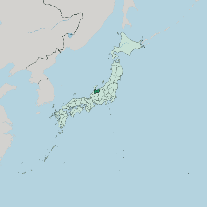


Towns & cities in Toyama-ken
Pick a town or city — each links to where to stay.
Base in the city of Toyama. Its station sits on the Hokuriku Shinkansen, a short walk from the fish market on Toyama Bay and the tram lines that thread the old castle town. For the Kurobe Gorge, the hot-spring town of Unazuki Onsen puts you at the mouth of the ravine.
Takaoka casts bronze and sends buses to Gokayama. In Gokayama itself, a few gassho farmhouses take overnight guests, letting you sleep under a thatched roof that has shed snow for generations.
About Toyama-ken
Toyama trades on extremes.
What is Toyama-ken known for?
The Tateyama Kurobe Alpine Route climbs from the shore of Toyama Bay to walls of snow near the summit of Tateyama, one of Japan's three sacred peaks. Below it, Toyama Bay yields firefly squid and glassy white shrimp prized across the country. Gokayama guards its steep-roofed gassho farmhouses.
And the prefecture built a national name in medicine, sending door-to-door drug peddlers out from Etchū across Japan for generations.
Where is Toyama-ken?
Toyama faces the Sea of Japan. The prefecture occupies the old land of Etchū in the Hokuriku region of central Honshū, a broad plain that opens north to the water and is closed on its other three sides by mountains. Ishikawa lies to the west, Gifu to the south, Nagano to the east, and Niigata to the northeast. Across the bay to the west, the Noto Peninsula of Ishikawa curls out to shelter the water.
The Hida Mountains raise that eastern and southern wall. Their ridgelines run high. Tateyama, one of Japan's three holy mountains, clears three thousand metres, and the drop from its summit to the deep floor of Toyama Bay measures close to four thousand metres.
Snowmelt feeds the Kurobe River, which has carved the Kurobe Gorge on its plunge to the coast. The Jinzū River braids across the lowland too. At the coast, a fan of alluvial plain carries the rice fields and nearly every town, hemmed between the peaks and the shore.
Small glaciers still cling to the highest cirques, among the first confirmed in Japan. The peaks are never far off.
What is Toyama-ken like?
Toyama built its name on medicine. Under the old Etchū domain, travelling salesmen carried lacquered chests of household remedies across Japan on foot, leaving the medicine and collecting payment only for what a family had used. That trade still shapes the prefecture, and its factories remain a centre of the drug industry.
Craft runs deep alongside it. Takaoka has cast bronze for four hundred years, from temple bells and its great bronze Buddha to the metalwork sold in the old merchant quarter of Kanaya-machi. In the Gokayama valleys, villagers still sing the Kokiriko, counted among the oldest folk songs in Japan.
The mountains carry their own faith. Tateyama drew pilgrims for centuries as one of the country's three holy mountains, a place of mountain worship where ascetics climbed toward what they pictured as paradise and hell laid side by side. Each September the town of Yatsuo dances the Owara Kaze no Bon by lantern light, its musicians drawing crowds into the hillside lanes.
The table leans on the sea. Toyama Bay sushi, firefly squid, and kelp carried north by old cargo ships all sit at the centre of the local kitchen. Snow shapes the rest.
What is the history of Toyama-ken?
This was Etchū Province. For most of its history the land answered to the powerful Maeda lords of Kaga, until a branch of the family took the Toyama domain as its own seat in 1639. Under those lords the medicine trade took root and spread across the country.
After the domains fell, the area was briefly called Niikawa, then folded into Ishikawa, before Toyama Prefecture stood on its own in 1883. Then the rivers went to work. Engineers dammed the Kurobe River for hydroelectric power, and cheap current pulled aluminium and chemical works onto the Toyama plain.
What is the climate of Toyama-ken?
Snow defines the winter here. Cold air pouring off Siberia picks up moisture over the Sea of Japan, then dumps it as snow when the Hida Mountains force it upward, burying the plain from December through March. Higher up on the Tateyama plateau at Murodō, the drifts pile into some of the deepest snow on earth.
Ploughs cut a corridor through walls of snow each spring. Summers turn warm and sticky on the lowland, wrung out by the same mountains that trap the winter cloud. The wind can flip warm and dry.
How do you get to Toyama-ken?
The fast way is the train. The Hokuriku Shinkansen runs from Tokyo to the city of Toyama in around two hours, sweeping up the spine of Honshū and under the Northern Alps on the way. Toyama Airport adds short flights from Tokyo's Haneda, a little south of the city centre.
From the Nagano side, the Tateyama Kurobe Alpine Route crosses the mountains by cable car, ropeway, and tunnel bus into the prefecture. Local trains carry on from there. The Toyama Chihō Railway climbs toward Tateyama Station, and a switchback line threads the Kurobe Gorge to Unazuki Onsen.
Good for
Updated July 2026