Mexico
Estado de Querétaro, Mexico — Towns & Travel Guide


One of Mexico's smaller states, filling a stretch of the Bajío where irrigated valleys climb north into the canyons of the Sierra Gorda.
About Estado de Querétaro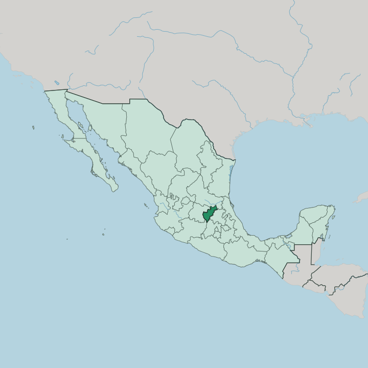


Towns & cities in Estado de Querétaro
Pick a town or city — each links to where to stay.
Let Santiago de Querétaro be your first stop. Santiago de Querétaro keeps its colonial grid, shaded plazas and long stone aqueduct intact, and most trips begin there before fanning out across the rest of the small state. For wine and cheese, the vineyard towns of Tequisquiapan and Ezequiel Montes lie an easy drive east.
Bernal draws walkers to the foot of the Peña de Bernal. San Juan del Río anchors the industrial Bajío to the south, while Jalpan de Serra is the springboard for the Sierra Gorda far to the north. The state stays compact.
Pick the capital first; head for the sierra or the vineyards when you want the quieter country.
About Estado de Querétaro
Two UNESCO listings anchor the state.
What is Estado de Querétaro known for?
The colonial core of Santiago de Querétaro, laced with a long stone aqueduct and shaded plazas, sits alongside the Franciscan missions that Junípero Serra raised deep in the Sierra Gorda. Travellers also come for the Peña de Bernal, one of the world's tallest monoliths, rising above the small town of Bernal. Around Tequisquiapan and Ezequiel Montes runs a wine-and-cheese route through vineyards and dairy country.
History clings to the place too, from the independence conspiracy hatched in the capital to the 1917 constitution drafted at the Teatro de la República.
Where is Estado de Querétaro?
Querétaro is one of Mexico's smaller states, wedged into the middle of the country in the fertile lowland belt called the Bajío. It shares borders with five states. Guanajuato lies to the west, San Luis Potosí to the north, Hidalgo to the east, the State of México to the south-east and Michoacán to the south-west. The land tilts and folds from one edge to the other.
Around the capital, Santiago de Querétaro, sit broad valleys and irrigated plains that feed the Bajío's farms and factories. East and north of them the ground dries into the Semidesierto, a scrub-and-cactus country of low mesas. Then the terrain rears up.
The northern third of the state climbs into the Sierra Gorda, a rugged spur of the Sierra Madre Oriental of high peaks, deep canyons and limestone caves. Rivers such as the Moctezuma have cut those canyons on their way north toward the Pánuco basin and the Gulf. No coast touches the state anywhere.
It is landlocked on every side, closer in feel to the central highlands than to either Mexican shore. That mix of desert, farm valley and cloud-forested sierra, packed into one small state, is what makes Querétaro's geography unusual.
What is Estado de Querétaro like?
Two Mexicos meet in Querétaro. In the arid centre and south, Otomí communities still speak their own tongue and weave wool and cotton on backstrap looms, a presence that predates the Spanish by centuries. Spanish is the common language everywhere.
The colonial capital sets the tone for much of the state, with its convent churches, arcaded courtyards and the evening crowds on the Plaza de Armas. Faith is written into the landscape as well. Deep in the Sierra Gorda stand five Franciscan mission churches, their façades carved by Otomí and Pame hands under the friar Junípero Serra, and the mission at Jalpan de Serra is the grandest of them.
Music carries its own map here. The Sierra Gorda is huapango country, where fiddle-and-guitar sones and improvised verse fill village fiestas, and the town of San Joaquín hosts a huapango contest each spring. Food and drink pull travellers the other way, toward the vineyards and cheese dairies around Tequisquiapan and Ezequiel Montes.
Querétaro sits between old and new. Aerospace plants and universities ring the capital while, an hour north, mule tracks still climb to hamlets in the sierra.
What is the history of Estado de Querétaro?
Spanish forces took the Otomí settlement here in 1531 and made Querétaro a way-station on the silver road north. The city earned its place in national memory in 1810, when Josefa Ortiz de Domínguez, wife of the local magistrate, warned the independence plotters that their conspiracy was discovered. Fame of a darker kind followed.
Emperor Maximilian I surrendered here and was shot on the Cerro de las Campanas in 1867, ending the French-backed empire. Half a century later the state gave Mexico its founding charter: the 1917 Constitution was signed at the Teatro de la República, still the country's governing document.
What is the climate of Estado de Querétaro?
Altitude rules the weather more than the seasons do. The valleys around Santiago de Querétaro sit high enough to stay temperate and dry, with warm days, cool nights and most rain falling in short summer storms. The Semidesierto to the east is harsher and browner, baked and thinly watered.
Everything changes in the Sierra Gorda. Its slopes stack climates within a few miles, from thorn scrub in the low canyons up through oak and pine to cloud forest wrapped in fog near the peaks. Frost is rare; drought is the real constraint.
How do you get to Estado de Querétaro?
Most travellers reach Querétaro by road. Federal Highway 57 runs straight up from Mexico City, a drive of about three hours that makes the state an easy weekend from the capital and a freight artery for the whole Bajío. For those flying, Querétaro Intercontinental Airport sits east of the city near Colón, with domestic links and a handful of United States routes.
The Sierra Gorda is the slow part. Reaching Jalpan de Serra and the mission villages means a winding mountain road north through Pinal de Amoles, hours from the nearest runway.
Updated July 2026