Iran
North Khorasan Province, Iran — Towns & Travel Guide


A mountainous province in north-eastern Iran on the Turkmenistan border, North Khorasan centres on Bojnord and its Kurdish and Turkmen towns.
About North Khorasan Province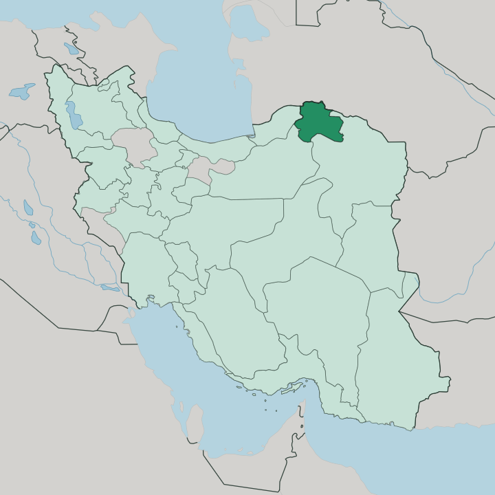
Towns & cities in North Khorasan Province
Pick a town or city — each links to where to stay.
Bojnord is the practical base, the only city with a real spread of hotels and the province's main transport hub. Start your visit in Bojnord. From there the province fans out along two axes: south toward Esfarayen and its ruined Belqeys citadel, and east along the Quchan road through Shirvan, the heart of Kurmanji dotār country.
Jajarm sits apart, out on the dry southern edge where the national railway comes in. Outside the capital, expect guesthouses over hotels. If music and mountains matter more to you than comfort, base in the smaller Kurdish towns and travel light.
About North Khorasan Province
North Khorasan is known above all for its music.
What is North Khorasan Province known for?
The dotār, a two-stringed lute played by travelling bards called bakhshis, carries the province's Kurdish and Turkmen poetry, and UNESCO inscribed that tradition in 2010. Bojnord anchors the region. The city sits in a green valley near the Atrek, ringed by the Aladagh range and the Kopet Dag along the Turkmenistan frontier.
Few foreign travellers reach it.
Where is North Khorasan Province?
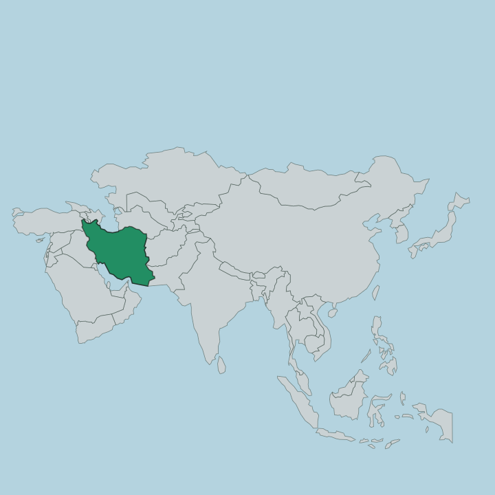
North Khorasan lies in the far north-east of Iran, a wedge of mountain and valley pressed against the Turkmenistan border. Turkmenistan runs along its whole northern edge. Razavi Khorasan wraps the east and south, Semnan lies to the south-west, and Golestan closes the western side toward the Caspian lowlands. It is a landlocked interior province, well off the routes most visitors to Iran ever take.
Yet for centuries its valleys carried traffic between the Iranian plateau and the steppes of Central Asia, a corridor of the old Silk Road. Two mountain systems define the land. The Kopet Dag rises along the Turkmen frontier in the north, and the Aladagh range walls off the south, with the peak of Shah Jahan standing above the rest.
Between them run long valleys where nearly all the towns and farms sit. The Atrek, the region's main permanent river, gathers in these highlands and bends west along the border country, giving Bojnord and its valley their unexpected green. Snowmelt feeds the fields in spring.
South of the ranges the country dries out toward the semi-desert margins around Jajarm, where salt flats and open steppe replace the orchards. Bojnord itself sits high, cool for its region.
What is North Khorasan Province like?
North Khorasan is one of Iran's most mixed provinces, and its make-up is unusual for the country's east. Kurds are the largest group. They speak Kurmanji, the northern form of Kurdish, and most are Shia rather than Sunni, the legacy of tribes the Safavid shahs resettled here in the sixteenth and seventeenth centuries to hold the frontier against raiders from the steppe.
Turkmen villages line the northern border near Turkmenistan, descended from Oghuz nomads. Persians fill Bojnord and the southern towns, and Khorasani Turks add another layer. Four peoples share these valleys.
Music binds the province together more than any single language. The bakhshis are travelling bards who accompany themselves on the dotār, a long-necked two-stringed lute, and recite epics, Sufi verse and village history from memory. UNESCO placed their art on its heritage list in 2010.
Shirvan, Bojnord and Esfarayen are its strongholds. Beyond the music, the culture shows in hand-woven kilims, in Kurdish and Turkmen dress worn at weddings, and in the wrestling and horsemanship of village festivals. It is a border culture, Iranian at its core but shaped by the steppe.
What is the history of North Khorasan Province?
North Khorasan is a young administrative unit on very old ground. It was carved out in 2004, when Iran split the huge former province of Khorasan into three, giving the northern districts their own capital at Bojnord. The land itself belongs to Greater Khorasan, a crossroads fought over by Persians, Turks, Mongols and others for a thousand years.
Its more recent shape was set by the Safavids, who moved Kurdish tribes here to guard the frontier, and by the Shadlu Kurdish khans who ruled Bojnord and left the Mofakham mansion behind. New on the map, ancient underneath.
What is the climate of North Khorasan Province?
The mountains set the weather here. Bojnord and the upland valleys have cold, snow-bound winters and warm, dry summers, tempered by their height in the Aladagh and Kopet Dag ranges. Spring is the season the province wears best, when snowmelt greens the Atrek valley and wildflowers cover the slopes.
Rain is sparse and falls mostly in the cold months. South toward Jajarm the air turns hot and desert-dry, a different climate within the same province. Its gentlest months are spring and early autumn.
How do you get to North Khorasan Province?
Reaching North Khorasan takes some effort. Bojnord has a small airport with domestic flights to Tehran, but the usual door is Mashhad, the big regional hub several hours east by road. Buses and shared taxis run the mountain highway from Mashhad to Bojnord in about half a day.
From the west, the road down from Gorgan crosses green foothills into the province. Trains reach only as far as Jajarm, in the south. Inside the province, travel means the road.
Good for
Updated July 2026