Japan
Okayama-ken, Japan — Towns & Travel Guide


Okayama-ken is a sun-blessed prefecture of western Japan, facing the Seto Inland Sea from the Chūgoku region of Honshu.
About Okayama-ken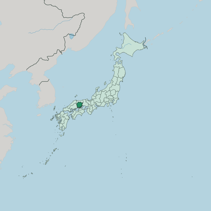


Towns & cities in Okayama-ken
Pick a town or city — each links to where to stay.
Two cities anchor a stay. Okayama city sits in the middle of the coastal plain, its castle and Kōraku-en beside the Asahi River and its station on the main bullet-train line, which makes it the easiest base for a first visit. Kurashiki, a short hop west, trades the big-city feel for willow-lined canals and the white-walled Bikan quarter, with the denim workshops of Kojima to the south.
For the Seto Inland Sea itself, the port of Uno gives onto the island-hopping boats, and the Great Seto Bridge carries the road south to Shikoku.
About Okayama-ken
What is Okayama-ken known for?
Okayama-ken is best known for Kōraku-en, one of the three great landscape gardens of Japan, laid out on an island in the Asahi River across from the black keep of Okayama Castle. It bills itself the Land of Sunshine. Its warm, dry Setouchi weather ripens the white peaches and Muscat grapes that the prefecture ships across Japan.
West of the capital, the canal quarter of Kurashiki keeps its white-walled Edo-era warehouses, and the district of Kojima gave the country its first homegrown denim. Bizen ware, the unglazed stoneware fired east of the city, has come out of the same kilns for more than a thousand years.
Where is Okayama-ken?
Okayama-ken lies in the Chūgoku region of Honshu, along the northern shore of the Seto Inland Sea, facing the island of Shikoku across the sheltered water. Three prefectures ring it by land. Tottori Prefecture sits to the north beyond the crest of the Chūgoku Mountains, Hyōgo Prefecture closes the eastern border, and Hiroshima Prefecture the western one. The Great Seto Bridge carries road and rail south to Shikoku.
Inland, the land climbs. The north is high and forested, a country of basins and steep river valleys folded into the Chūgoku range, where winter snow lies far longer than it does on the coast. Between those peaks and the sea spreads the Kibi Highlands, a belt of low hills and terraced fields.
Three rivers drain southward across it, the Yoshii, the Asahi, and the Takahashi, and their silt built the flat coastal plain where most of the prefecture's people live. Okayama city stands on that plain, where the Asahi River bends past the castle grounds. Offshore, the Seto Inland Sea breaks into dozens of small islands.
The whole span from ridge to shore is short.
What is Okayama-ken like?
Okayama-ken carries the legend of Momotarō, the boy born from a peach who sets out to fight the ogres of a nearby island. The tale is tied to the old Kibi country and the shrine of Kibitsu, and the prefecture has claimed the Peach Boy as its own for generations. The prefecture's craft traditions reach back just as far.
Potters in the town of Bizen have fired Bizen ware, a reddish and unglazed stoneware, from local clay since the age of Japan's ancient kilns. To the west, the merchant town of Kurashiki turned its canal-side wealth into art, and the Ōhara Museum of Art there opened the country's first collection of Western painting. The daimyō left their mark on the land as well.
The Ikeda lords who ruled from Okayama Castle laid out Kōraku-en on the far bank of the Asahi River, a strolling garden of lawns, ponds, and borrowed views of the black keep. Festivals keep the older rhythms. Each winter thousands of men in loincloths pack the hall of Saidaiji temple for the Eyō, a scramble in the dark for a pair of sacred wooden batons.
The everyday culture is quieter, fruit orchards, denim ateliers, and the flat local speech of Japanese heard along the Setouchi coast. Food follows the seasons here, from early-summer peaches to Okayama's scattered barazushi.
What is the history of Okayama-ken?
Before the modern map, the land was three provinces, Bizen, Bitchū, and Mimasaka. Ukita Hideie raised the black-walled keep of Okayama Castle around the close of the sixteenth century. After the battle of Sekigahara the Ikeda clan took the domain, ruled from that castle, and built the garden of Kōraku-en beside it.
When the Meiji government swept away the old feudal domains in 1871, the three provinces were fused into a single prefecture. The borders settled a few years later. Okayama city has been its centre ever since.
What is the climate of Okayama-ken?
Okayama-ken calls itself the Land of Sunshine, and the name is earned. The peaks of the Chūgoku Mountains to the north and the hills of Shikoku to the south wring the rain out of passing fronts, so the Seto Inland Sea plain sees more clear days and fewer downpours than almost anywhere in Japan. Summers are warm and humid, winters mild along the coast.
Snow is rare on the plain. Up in the northern basins the higher ground turns properly cold and snowy each winter.
How do you get to Okayama-ken?
Okayama city is the region's hinge. Its station is a stop on the Sanyō Shinkansen, the main bullet-train spine running west from Ōsaka toward Hiroshima, which puts the prefecture within a fast ride of the big cities of Honshu. From that same station the Seto-Ōhashi line branches south, crossing the Great Seto Bridge to Shikoku.
Okayama has its own airport in the hills north of the city. Local trains and buses fan out from the capital to Kurashiki and the coast.
Good for
Updated July 2026