Japan
Tottori, Japan — Towns & Travel Guide


Tottori is a prefecture on the Sea of Japan coast of western Japan, known for the largest sand dunes open to visitors in the country.
About Tottori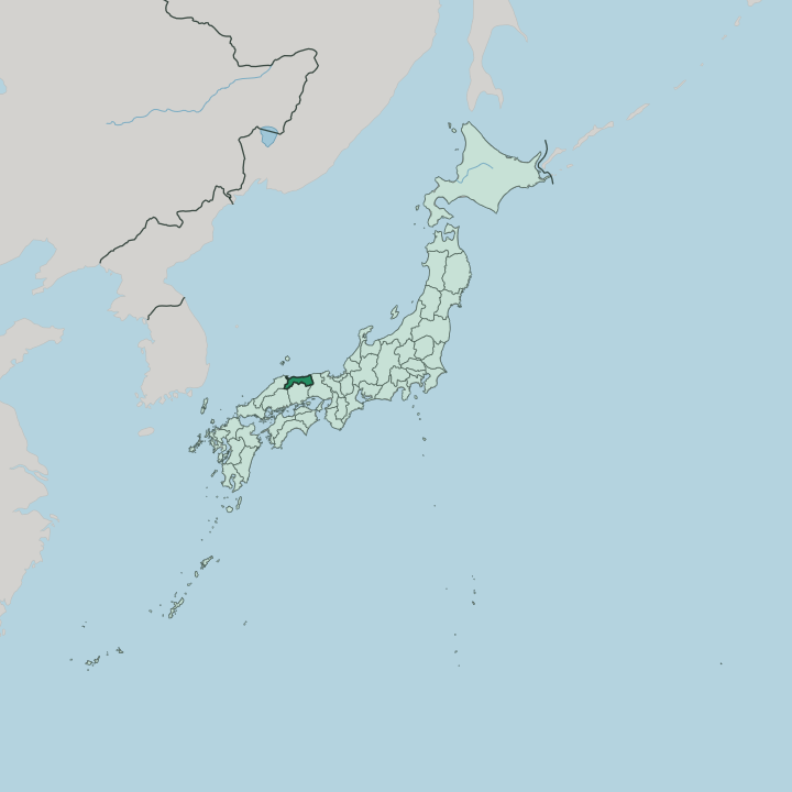


Towns & cities in Tottori
Pick a town or city — each links to where to stay.
Where to sleep depends on the draw. Tottori, the prefectural capital, sits closest to the sand dunes and the eastern coast, and it makes the natural first stop for most visitors arriving from the east. Yonago anchors the western end, close to Mount Daisen and the border with Shimane Prefecture.
Sakaiminato guards the harbour mouth where the crab boats land. Kurayoshi keeps the quiet centre, its white-walled storehouses lined along the Tamagawa. Choose the capital for a first visit; choose the coast or the mountain foot when you want a slower pace.
About Tottori
Sand is the first thing people picture.
What is Tottori known for?
The Tottori Sand Dunes stretch along the Sea of Japan for some 16 kilometres, the largest dune field open to the public in Japan, where visitors ride camels and sandboard down the slopes. Inland the land climbs to Mount Daisen, the highest peak of the Chūgoku region and a dormant volcano ringed by beech forest. Much of this coast forms the San'in Kaigan Geopark.
The cold northern sea also feeds the kitchens, and winter brings the prized matsuba snow crab to the ports.
Where is Tottori?
Tottori occupies the eastern half of the San'in coast, the shore of western Honshū that faces the Sea of Japan. It is the least populous prefecture in Japan. The land forms a long, narrow band pressed between the water and the mountains, rarely more than a short drive from crest to surf.
Behind the coast rise the Chūgoku Mountains, and from them Mount Daisen lifts above everything else, the tallest peak in the whole Chūgoku region. Four prefectures ring it on land: Hyōgo Prefecture to the east, Okayama Prefecture over the mountains to the south, Hiroshima at a short south-western corner, and Shimane Prefecture along the western border. The open sea takes every other edge.
The coastline does the rest of the work. East of the capital the Tottori Sand Dunes pile up where the Sendai River empties its sediment into the sea, then wind carries the sand back ashore. Farther east the shore breaks into the rocky coves and sea caves of the Uradome Coast, part of the San'in Kaigan Geopark that runs into Hyōgo Prefecture.
The Sea of Japan sets the terms here. It brings the fish, the winter snow, and the sand that made the prefecture famous.
What is Tottori like?
Tottori keeps a quiet, rural character, the emptiest of Japan's prefectures, and it wears its folklore openly. Yōkai, the spirits and monsters of old Japanese tales, are the local celebrities. Sakaiminato was the boyhood home of Shigeru Mizuki, whose manga fixed those creatures in the national imagination, and its main street sets 178 bronze yōkai along the pavement as Mizuki Shigeru Road.
The comics tradition runs deeper still. Gōshō Aoyama, who created the detective series read across Japan, grew up on the same coast, and the prefecture leans hard into both artists. Food and water shape the rest.
The Sendai valley grows the pale Nijisseiki pear, one of the country's most planted, while the winter sea sends the matsuba snow crab to table. Hot springs are everywhere along this coast. Misasa built its baths on radon-rich water inland, and Kaike steams beside the sea near Yonago.
Above it all sits Mount Daisen, holy long before it was a ski hill. Daisen-ji temple has clung to its slopes for over a thousand years, and mountain ascetics once climbed the peak as an act of worship.
What is the history of Tottori?
Two old provinces sit under the modern prefecture. Inaba in the east and Hōki in the west were the historic realms here, and the powerful Ikeda house ruled both from Tottori Castle through the long peace of the Edo period. The prefecture itself was drawn in 1871, when the abolition of the feudal domains redrew the map of Japan.
Its early years were unsettled. For five years the territory was folded into Shimane Prefecture, until local pressure won it back, and the separate Tottori Prefecture was re-established in 1881.
What is the climate of Tottori?
Winter is the season that defines Tottori. Cold air crossing the Sea of Japan picks up moisture and drops it as heavy snow along the San'in coast, deepest around the new year, and Mount Daisen gathers enough of it to run ski slopes. Summers turn warm and humid instead.
The wet months come late, with the heaviest rain near the turn to autumn rather than midsummer. It is a grey, damp coast for much of the cold half of the year.
How do you get to Tottori?
No bullet train reaches Tottori. The quickest rail run is the Super Hakuto limited express, which leaves Osaka and cuts north through the mountains on the Chizu line in about two and a half hours. Travellers off the Sanyō Shinkansen change at Okayama and cross the passes on a connecting express.
Flying is the other option. Two small airports serve the prefecture, one near the sand dunes in the east and one by Yonago in the west, both with links to Tokyo. Along the coast, the San'in Main Line threads the shoreline towns together from the capital west to Yonago.
Good for
Updated July 2026