United States
Idaho, United States — Towns & Travel Guide


Idaho is a Rocky Mountain state in the northwestern United States, cut by deep river canyons and the broad Snake River Plain.
Find your area →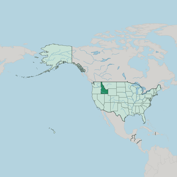
Towns & cities in Idaho
Pick a town or city — each links to where to stay.
 United States
Boise
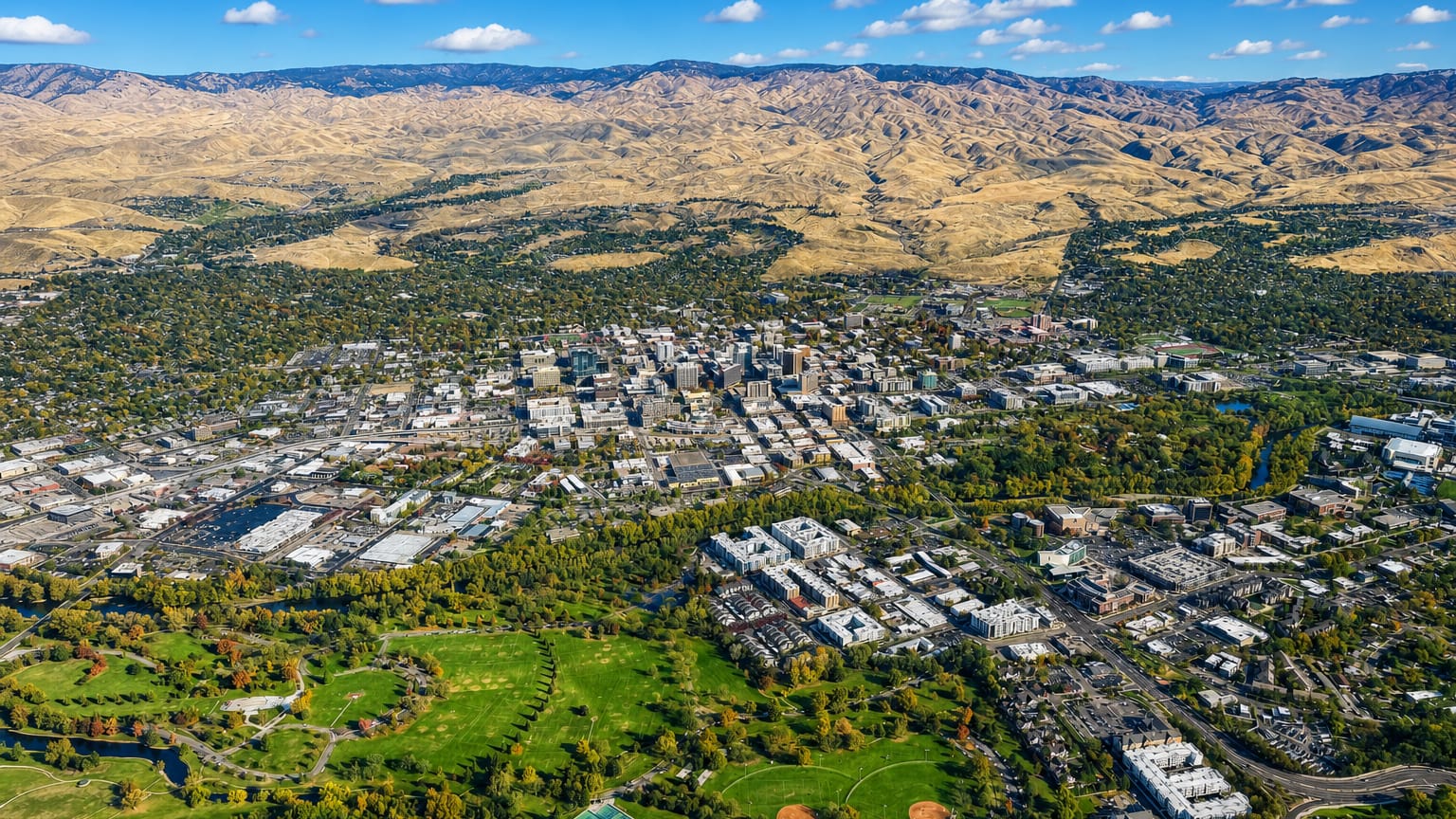
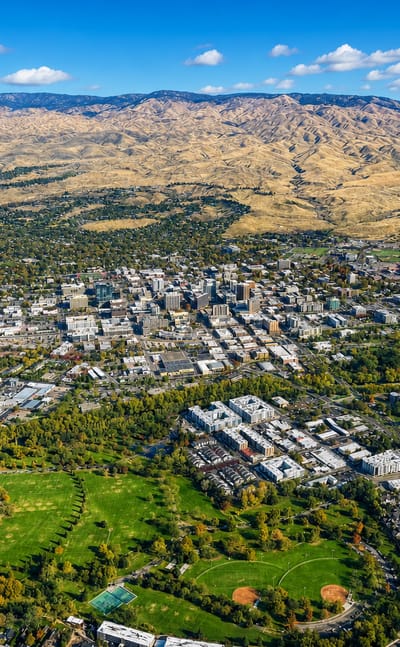
Boise is a city in Idaho, seat of state government since 1863, known for the Cathedral of St. John the Evangelist and the Boise Art Museum.Where to stay →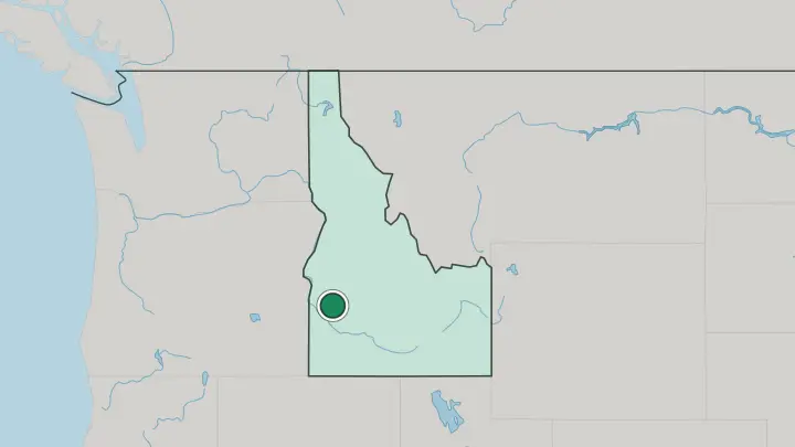
About Idaho
Idaho trades on the outdoors.
What is Idaho known for?
The state packs snow-capped ranges, whitewater rivers, and some of the deepest canyons in North America into one map. The Snake River carves across the south, and along the Oregon line it drops into Hells Canyon, the deepest river gorge in the country. Skiers know Sun Valley, one of the first purpose-built resorts in America.
Farmers know the Snake River Plain, whose volcanic soil grows more potatoes than any other state. Boise, the capital, anchors it all.
Where is Idaho?
Idaho sits in the northwestern United States, wedged into the Rocky Mountains between the Pacific coast states and the northern plains. Six states ring it. Washington and Oregon lie to the west, Nevada and Utah to the south, and Montana and Wyoming to the east. To the north the state narrows into a slender panhandle that runs up to a short border with British Columbia in Canada.
That narrow top gives Idaho one of the most lopsided shapes of any western state, broad at the base and pinched to a strip near the Canadian line. Mountains fill most of what lies inside those borders. Ranges pile up across the centre and north, cut by the deep trenches of the Salmon River and the Clearwater, while Borah Peak rises above the rest as the highest ground in the state.
The one great lowland is the Snake River Plain, a broad arc of volcanic country that curves across the south and carries most of the people and nearly all the farmland. The Snake River itself loops through that plain before turning north to slice Hells Canyon along the Oregon border, the deepest river gorge on the continent. Lakes gather in the panhandle.
Water runs through nearly everything here.
What is Idaho like?
Idaho lives outdoors. Life here bends toward the rivers, the ski hills, and the public forests that cover much of the state, and a weekend often means a raft, a trail, or a rod rather than a city street. The old work of the land still sets the tone.
Ranching, logging, and mining built the towns, and farming on the Snake River Plain made the potato into a state emblem stamped on the licence plates. English is the common language. Away from Boise the towns thin out fast, and long drives between them are simply part of the deal.
Boise gathers what passes for city life, its centre holding the Basque Block, heart of the largest Basque community in the United States. That heritage traces back to shepherds who came for the open range. Older still are the first peoples of this land.
The Nez Perce, the Shoshone, and the Coeur d'Alene hold reservations and treaty rights across the state, and their names mark its rivers, lakes, and mountain passes. Sun Valley adds a different note. The resort drew Hollywood and writers up into the mountains, Ernest Hemingway among them, and left a strain of glamour in a state better known for gravel roads.
What is the history of Idaho?
People have lived on this land for thousands of years, among them the Shoshone and the Nez Perce. In 1805 the Lewis and Clark Expedition crossed the mountains at Lemhi Pass, guided through by those same peoples, the first Americans known to enter the region. Then came the gold.
Strikes in the 1860s brought a rush of settlers, and Idaho Territory was carved out in 1863 with Lewiston as its first capital. War with the Nez Perce broke over the influx in 1877. Idaho joined the Union as its 43rd state in 1890.
What is the climate of Idaho?
Climate in Idaho splits with the terrain. The Snake River Plain runs dry and sunny, with hot summers, cold winters, and little rain, so the farms there lean on irrigation drawn from mountain snow. Up in the ranges the snow piles deep, which is what keeps Sun Valley and the other resorts in business.
The panhandle in the north catches wetter Pacific air and milder, greener winters. East toward Wyoming the seasons swing hard. Elevation matters more than anything.
How do you get to Idaho?
Most visitors fly into Boise, whose airport carries the bulk of the state's traffic and the widest run of connections. Smaller fields serve Sun Valley, Idaho Falls, and the panhandle, and the airport at Spokane just over the Washington line handles much of the north. Drivers reach the state easily.
Interstate 84 runs the length of the Snake River Plain, Interstate 15 drops in from Montana and Utah, and US 95 threads north through the panhandle to Canada. Distances are long. Come prepared to drive.
Good for
Updated July 2026