DoaluKnow the place before you book.
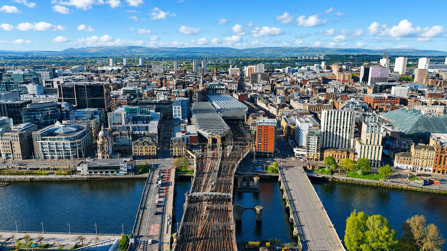
Aerial view of Glasgow with railway bridges crossing the River Clyde into the city centre

United Kingdom · Scotland

Where to Stay in Glasgow, Scotland

Deep-red sandstone lines the River Clyde at Glasgow, the largest city in Scotland, known for Glasgow Cathedral and the Kelvingrove Art Gallery and Museum.

Find your area →
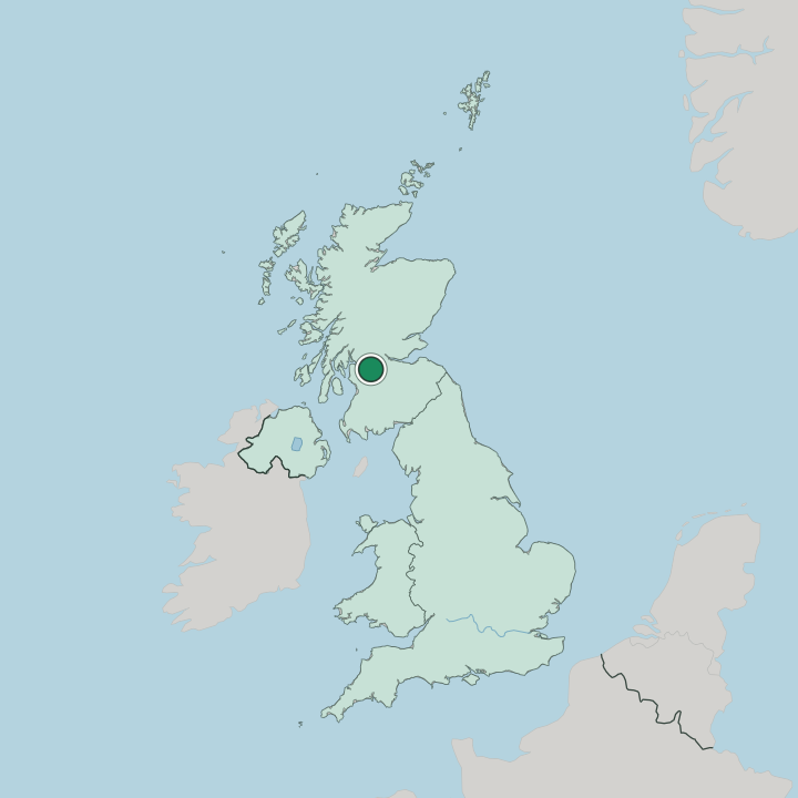
Where to stay in Glasgow

The right area depends on your trip — here's what each neighbourhood is best for.

Aerial view of Glasgow with railway bridges crossing the River Clyde into the city centreGlasgowUnited Kingdom

Whiteinch

Whiteinch lines the north bank of the River Clyde between Partick and Scotstoun, a Glasgow district that once belonged to the burgh of Partick.Where to stay →
The River Clyde at Tradeston, Glasgow, with glass office blocks and the domed Clydeport building on the far bank.GlasgowUnited Kingdom

Tradeston

Tradeston is a small district on the south bank of the River Clyde, next to Glasgow city centre, named for its warehouses and wharves.Where to stay →
Aerial view of Glasgow with railway bridges crossing the River Clyde into the city centreGlasgowUnited Kingdom

Springburn

Springburn is an inner-city district in the north of Glasgow, with Balgray Tower standing on Broomfield Road among working-class streets.Where to stay →
Aerial view of Glasgow with railway bridges crossing the River Clyde into the city centreGlasgowUnited Kingdom

Shieldhall

Shieldhall is a Glasgow district south of the River Clyde, part of the wider Govan area and the address of the National Badminton Academy.Where to stay →
Aerial view of Glasgow with railway bridges crossing the River Clyde into the city centreGlasgowUnited Kingdom

Provanmill

Provanmill is a district on the north-east side of Glasgow, a former mill hamlet drawn into the city as its streets spread outward.Where to stay →
Tree-lined residential street of roughcast semi-detached houses in Pollok, Glasgow.GlasgowUnited Kingdom

Pollok

Pollok is a large housing estate on the south-western side of Glasgow, built either side of World War II for families moved out of the inner city.Where to stay →
Red sandstone Victorian hall and tenements on a sunlit street corner in Kinning Park, Glasgow.GlasgowUnited Kingdom

Kinning Park

Kinning Park is a southern suburb of Glasgow, a separate police burgh until 1905, and the site of the Scotland Street School Museum.Where to stay →
Aerial view of Glasgow with railway bridges crossing the River Clyde into the city centreGlasgowUnited Kingdom

Kings Park

King's Park is a Glasgow district south of the River Clyde, ringed by Croftfoot, Cathcart, Simshill, Mount Florida and Toryglen.Where to stay →
Aerial view of Glasgow with railway bridges crossing the River Clyde into the city centreGlasgowUnited Kingdom

Hillington

Hillington is a district of Glasgow, in Scotland, whose one recorded marker is Cardonald Parish Church on Paisley Road West.Where to stay →
All neighbourhoods (80)
Stepped riverside apartment blocks lining a wide road in Finnieston, Glasgow, under a bright skyGlasgowUnited Kingdom

Finnieston

Finnieston lines the River Clyde's north bank in Glasgow, between the West End and the city centre, with the SEC Centre and OVO Hydro at its edge.Where to stay →
Aerial view of Glasgow with railway bridges crossing the River Clyde into the city centreGlasgowUnited Kingdom

Drumchapel

Drumchapel takes its name from Gaelic words for the ridge of the horse, and undeveloped land beyond it carries the Antonine Wall.Where to stay →
The red iron Dalmarnock Bridge crossing the River Clyde beside a riverside path in Glasgow.GlasgowUnited Kingdom

Dalmarnock

Dalmarnock is a district of Glasgow east of the city centre, on the north side of the River Clyde facing the town of Rutherglen.Where to stay →
Bowling green backed by sandstone tenements and interwar houses in Cardonald, Glasgow.GlasgowUnited Kingdom

Cardonald

Cardonald, or Cair Dhòmhnaill, is an outlying suburb to the southwest of Glasgow, bounded on the south by the White Cart Water.Where to stay →
Aerial view of Glasgow with railway bridges crossing the River Clyde into the city centreGlasgowUnited Kingdom

Anniesland

Anniesland is a district of Glasgow strung along Crow Road, with New Anniesland, Arnwood Drive and neighbouring Jordanhill around it.Where to stay →
Rooftops of Darnley's housing estates in southern Glasgow, framed by trees and distant hills.GlasgowUnited Kingdom

Darnley

Darnley is an area in south-west Glasgow on the A727, with the Brock Burn running through it and the Glasgow Museums Resource Centre alongside.Where to stay →
Aerial view of Glasgow with railway bridges crossing the River Clyde into the city centreGlasgowUnited Kingdom

Auldhouse

Auldhouse lies south of the River Clyde in Glasgow, strung along the Auldhouse Burn where it runs down toward the White Cart Water.Where to stay →
Winding paths and lawns of Kelvingrove Park in Glasgow, with the university's tower rising above spring trees.GlasgowUnited Kingdom

Kelvingrove

Kelvingrove borders Kelvingrove Park and the Art Gallery grounds in Glasgow's West End, north of the River Clyde and west of Charing Cross.Where to stay →
Aerial view of Glasgow with railway bridges crossing the River Clyde into the city centreGlasgowUnited Kingdom

Cowcaddens

Cowcaddens is an area on the northern fringe of Glasgow city centre, bordered by Garnethill and Townhead, and holding the National Piping Centre.Where to stay →
Sandstone tenements and a red double-decker bus on a street in Merchant City, Glasgow, with a clock steeple beyond.GlasgowUnited Kingdom

Merchant City

The Merchant City runs east from George Square to Glasgow Cross, a central quarter of Glasgow renamed during the urban renewal of the 1980s.Where to stay →
Knightswood's white interwar semi-detached cottages and hedged gardens below Glasgow tower blocksGlasgowUnited Kingdom

Knightswood

Knightswood is a suburban district in the West End of Glasgow, split into High Knightswood, Low Knightswood and Knightswood Park.Where to stay →
Aerial view of Glasgow with railway bridges crossing the River Clyde into the city centreGlasgowUnited Kingdom

Wyndford

Wyndford is a Maryhill neighbourhood in Glasgow, built as council housing between Maryhill Road and the River Kelvin.Where to stay →
YorkhillGlasgowUnited Kingdom

Yorkhill

Yorkhill is a hospital quarter of Glasgow's West End, north of the River Clyde and known for the medicine practised on its ground.Where to stay →
Aerial view of Glasgow with railway bridges crossing the River Clyde into the city centreGlasgowUnited Kingdom

Cowlairs

Cowlairs belongs to the wider Springburn district of Glasgow, north of the River Clyde, with Possilpark west of it and central Springburn east.Where to stay →
Aerial view of Townhead in Glasgow, with tower blocks, tenement rows, a church and the city skyline beyond.GlasgowUnited Kingdom

Townhead

Townhead is one of Glasgow's oldest districts, holding Glasgow Cathedral and Provand's Lordship, the city's two surviving medieval landmarks.Where to stay →
Aerial view of Glasgow with railway bridges crossing the River Clyde into the city centreGlasgowUnited Kingdom

Haghill

Haghill is a residential neighbourhood in the east end of Glasgow, hemmed in by Alexandra Park, Carntyne, Dennistoun and Parkhead.Where to stay →
Aerial view of Glasgow with railway bridges crossing the River Clyde into the city centreGlasgowUnited Kingdom

Barrowfield

Barrowfield is a Glasgow neighbourhood bounded by the Gallowgate and the A74, with Celtic Park immediately to the east.Where to stay →
Modern brick and render flats around a parking court in Royston, Glasgow, under a blue skyGlasgowUnited Kingdom

Royston

Royston, also written Roystonhill, is a Glasgow district once known as The Garngad, a name still shown in its local shops and bars.Where to stay →
Aerial view of Glasgow with railway bridges crossing the River Clyde into the city centreGlasgowUnited Kingdom

Shettleston

Shettleston lies in the east end of Glasgow, where Shettleston Road strings together a long run of parish churches.Where to stay →
Aerial view of Glasgow with railway bridges crossing the River Clyde into the city centreGlasgowUnited Kingdom

Hogganfield

Hogganfield sits north-east of the Glasgow city centre, ringed by Blackhill, Craigend, Millerston, Provanmill, Riddrie, Ruchazie and Stepps.Where to stay →
Aerial view of Glasgow with railway bridges crossing the River Clyde into the city centreGlasgowUnited Kingdom

Carmyle

Carmyle, also Cair Maol, is a suburb in the east end of Glasgow that keeps the character of a semi-rural village north of the River Clyde.Where to stay →
Aerial view of Glasgow with railway bridges crossing the River Clyde into the city centreGlasgowUnited Kingdom

Robroyston

Robroyston is a sprawling Glasgow suburb about three miles north-east of the city centre, with the Wallace Monument standing on Robroyston Road.Where to stay →
Aerial view of Glasgow with railway bridges crossing the River Clyde into the city centreGlasgowUnited Kingdom

Gartloch

Gartloch is a district of Glasgow, Scotland, whose single recorded building is the Nurses Home of Gartloch Hospital.Where to stay →
Aerial view over housing estates and green space toward the Glasgow city skyline from Ruchazie.GlasgowUnited Kingdom

Ruchazie

Ruchazie is a Glasgow neighbourhood on the north-east side, ringed by the M8 motorway and the open ground of Hogganfield Park.Where to stay →
Ross Hall's red sandstone Victorian mansion and modern wing above open lawns in Rosshall, Glasgow.GlasgowUnited Kingdom

Rosshall

Rosshall lies in the south-west of Glasgow, ringed by the White Cart Water, the Paisley Canal Line railway and green belt toward Paisley.Where to stay →
Traffic on the dual carriageway past red-brick tenements and terraces in Riddrie, Glasgow.GlasgowUnited Kingdom

Riddrie

Riddrie is a north-eastern district of Glasgow, on the A80 Cumbernauld Road, with High Cartyne Church and St Enoch Hogganfield Church nearby.Where to stay →
Aerial view of Glasgow with railway bridges crossing the River Clyde into the city centreGlasgowUnited Kingdom

Scotstounhill

Scotstounhill is a small area of western Glasgow, terraces and villas between Scotstoun and south Knightswood, with high-rise flats among them.Where to stay →
Mid-rise postwar housing blocks and grass verges along a main road in Penilee, Glasgow.GlasgowUnited Kingdom

Penilee

Penilee is a housing scheme on the south-western edge of Glasgow, with the Renfrewshire border on one side and Cardonald on the other.Where to stay →
Aerial view of Glasgow with railway bridges crossing the River Clyde into the city centreGlasgowUnited Kingdom

Partickhill

Partickhill is a Glasgow district of tenement closes, villas and terraced rows, held between Partick, Hyndland and Dowanhill.Where to stay →
Aerial view of Glasgow with railway bridges crossing the River Clyde into the city centreGlasgowUnited Kingdom

Kennishead

Kennishead is an isolated neighbourhood of Glasgow, Scotland, set south of the River Clyde between a park, a golf course and Carnwadric.Where to stay →
Hyndland, Glasgow: blonde sandstone Victorian terraces with bay windows lining a quiet parked-up street.GlasgowUnited Kingdom

Hyndland

Hyndland is a residential area in the West End of Glasgow, with Hyndland Parish Church, St Bride's Church and Belhaven-Westbourne Church inside it.Where to stay →
Blond sandstone terraces and a Gothic church spire on a tree-lined street in Kelvinside, Glasgow's West End.GlasgowUnited Kingdom

Kelvinside

Kelvinside is a Glasgow district of large Victorian villas and terraces, north of the River Clyde between Hyndland and the River Kelvin.Where to stay →
Aerial view of Glasgow with railway bridges crossing the River Clyde into the city centreGlasgowUnited Kingdom

Jordanhill

Jordanhill is an affluent West End district of Glasgow, largely terraced, holding Scotstoun Stadium and Jordanhill Parish Church.Where to stay →
Aerial view of Glasgow with railway bridges crossing the River Clyde into the city centreGlasgowUnited Kingdom

Balornock

Balornock is a Glasgow district north of the River Clyde, forming part of the larger area of Springburn outside the city centre.Where to stay →
Aerial view of Glasgow with railway bridges crossing the River Clyde into the city centreGlasgowUnited Kingdom

Lambhill

Lambhill is an area of Glasgow lying north of the River Clyde, about two miles out from the city centre.Where to stay →
Aerial view of Glasgow with railway bridges crossing the River Clyde into the city centreGlasgowUnited Kingdom

Gilshochill

Gilshochill stands on a hill north-west of Maryhill in Glasgow, above the point where two branches of the Forth and Clyde Canal meet.Where to stay →
Aerial view of Glasgow with railway bridges crossing the River Clyde into the city centreGlasgowUnited Kingdom

Cadder

Cadder is a district of Bishopbriggs in East Dunbartonshire, sitting on the Forth and Clyde Canal about 7 km north of Glasgow.Where to stay →
Tree-lined road past a shop parade with three white tower blocks beyond in Kelvindale, west Glasgow.GlasgowUnited Kingdom

Kelvindale

Kelvindale is a West End district of Glasgow, interwar tenements and semi-detached rows sharing the G12 postcode with Kelvinside and Hyndland.Where to stay →
Interwar semi-detached houses seen across a park in Garrowhill, east Glasgow, with tower blocks beyond.GlasgowUnited Kingdom

Garrowhill

Garrowhill is a residential quarter of the Baillieston suburb, roughly seven miles east of the Glasgow city centre.Where to stay →
Aerial view of Glasgow with railway bridges crossing the River Clyde into the city centreGlasgowUnited Kingdom

Barlanark

Barlanark is a Glasgow district framed by Shettleston, Baillieston and Easterhouse, with a single church on Shettleston Road to its name.Where to stay →
Aerial view of Glasgow with railway bridges crossing the River Clyde into the city centreGlasgowUnited Kingdom

Parkhead

Parkhead lies in the East End of Glasgow, bordered by Shettleston and Tollcross and holding the city's Eastern Necropolis beside the Gallowgate.Where to stay →
Aerial view of Glasgow with railway bridges crossing the River Clyde into the city centreGlasgowUnited Kingdom

Blairdardie

Blairdardie is a residential neighbourhood in north-west Glasgow, built in the 1950s and ringed by Knightswood, Drumchapel and Garscadden.Where to stay →
Aerial view of Glasgow with railway bridges crossing the River Clyde into the city centreGlasgowUnited Kingdom

Easterhouse

Easterhouse spreads over high ground east of central Glasgow, on land the city took from Lanarkshire when it expanded before the Second World War.Where to stay →
Aerial view of Glasgow with railway bridges crossing the River Clyde into the city centreGlasgowUnited Kingdom

Garthamlock

Garthamlock is a Glasgow suburb in the north-east of the city, marked by two water towers that are illuminated at night.Where to stay →
Aerial view of Glasgow with railway bridges crossing the River Clyde into the city centreGlasgowUnited Kingdom

Camlachie

Camlachie is an area in the East End of Glasgow, between Dennistoun and Bridgeton, once a weaving village on the Camlachie Burn.Where to stay →
Aerial view of Glasgow with railway bridges crossing the River Clyde into the city centreGlasgowUnited Kingdom

Gallowgate

Gallowgate is a neighbourhood of Glasgow named for the thoroughfare that runs through it, part of the A89 road, inside the city's Calton ward.Where to stay →
Sandstone tenements with bay windows lining a quiet street corner in Govanhill, GlasgowGlasgowUnited Kingdom

Govanhill

Govanhill sits south of the River Clyde in Glasgow, hemmed in by Pollokshields, the Gorbals, Strathbungo, Crosshill, Polmadie and Queen's Park.Where to stay →
Colourful modern brick housing terraces and apartment towers in Hutchesontown, Glasgow's Gorbals.GlasgowUnited Kingdom

Hutchesontown

Hutchesontown is an inner-city area of Glasgow directly south of the River Clyde, forming part of the wider historic Gorbals.Where to stay →
Stone-fronted semi-detached homes and open grassland in Croftfoot, a residential suburb of southern Glasgow.GlasgowUnited Kingdom

Croftfoot

Croftfoot, or Bun na Croite, is a housing area on the southeastern side of Glasgow, bordered by Castlemilk, King's Park and the Rutherglen edge.Where to stay →
Aerial view of Glasgow with railway bridges crossing the River Clyde into the city centreGlasgowUnited Kingdom

Muirend

Muirend is a commuter suburb on the South side of Glasgow, four miles out from the city centre and bordering Cathcart, Merrylee and Netherlee.Where to stay →
Aerial view of Glasgow with railway bridges crossing the River Clyde into the city centreGlasgowUnited Kingdom

Gorbals

The Gorbals stands on the south bank of the River Clyde, a former burgh of Glasgow drawn into the city as new industry pulled in workers.Where to stay →
Aerial view of Anderston, Glasgow: riverside offices and apartments beside the M8 motorway and the Clyde.GlasgowUnited Kingdom

Anderston

Anderston began as a village of handloom weavers and holds the north bank of the Clyde at the south-western edge of Glasgow city centre.Where to stay →
Aerial view of Glasgow with railway bridges crossing the River Clyde into the city centreGlasgowUnited Kingdom

Barmulloch

Barmulloch is a suburban area of Glasgow north of the River Clyde, built as post-war overspill housing on ground that had been rural.Where to stay →
Steep sandstone tenement street in Garnethill, Glasgow, looking down to the city centre skylineGlasgowUnited Kingdom

Garnethill

Garnethill is a residential quarter of Glasgow carrying an outsized set of public buildings, from the Glasgow School of Art to the Tenement House.Where to stay →
Aerial view of Glasgow with railway bridges crossing the River Clyde into the city centreGlasgowUnited Kingdom

Crossmyloof

Crossmyloof, or Crois MoLiubha, is an area on the south side of Glasgow between Pollokshields, Strathbungo and Shawlands.Where to stay →
Aerial view of Glasgow with railway bridges crossing the River Clyde into the city centreGlasgowUnited Kingdom

Hillpark

Hillpark is a Glasgow area south of the River Clyde, its listed churches and the old house at Auldhouse shared with neighbouring Pollokshaws.Where to stay →
Aerial view of Glasgow with railway bridges crossing the River Clyde into the city centreGlasgowUnited Kingdom

Mount Florida

Mount Florida holds the Scottish Football Museum, an area on the south-east side of Glasgow where three churches line Cathcart Road.Where to stay →
Red and blond sandstone tenements lining a sunlit street in Crosshill on Glasgow's Southside.GlasgowUnited Kingdom

Crosshill

Crosshill was an independent police burgh until Glasgow annexed it, a district south of the River Clyde lined with the churches of Queen's Drive.Where to stay →
Brick low-rise flats and parked cars on a sunlit residential street in Langside, southside Glasgow.GlasgowUnited Kingdom

Langside

Langside is a residential district of Glasgow south of the River Clyde, lying east of Shawlands and south of Queens Park.Where to stay →
Aerial view of Glasgow with railway bridges crossing the River Clyde into the city centreGlasgowUnited Kingdom

Port Dundas

Port Dundas is an area of Glasgow set a mile north of the city centre, its streets marked by Cedar Street, Lyon Street and Keppochhill Road.Where to stay →
HillheadGlasgowUnited Kingdom

Hillhead

Hillhead is an area of Glasgow's West End, between Kelvingrove Park and the River Kelvin, with Byres Road along its western edge.Where to stay →
Red sandstone villas with crow-stepped gables and iron railings along a Ruchill street in GlasgowGlasgowUnited Kingdom

Ruchill

Ruchill is a district of Glasgow in the Canal Ward, lying between Maryhill, Possilpark and North Kelvinside.Where to stay →
Aerial view of Glasgow with railway bridges crossing the River Clyde into the city centreGlasgowUnited Kingdom

North Kelvin

A residential district of Glasgow, North Kelvin, North Kelvinside in the record, is known through Queen's Cross Church and Garrioch Road.Where to stay →
High-rise blocks rising above open parkland in Carnwadric on Glasgow's south side.GlasgowUnited Kingdom

Carnwadric

Carnwadric is a residential area of Glasgow south of the River Clyde, bordered by the Arden housing estate, Thornliebank and the Auldhouse Burn.Where to stay →
Red and blonde sandstone Victorian villas on a leafy Dowanhill street in Glasgow's West End.GlasgowUnited Kingdom

Dowanhill

Glasgow's West End holds Dowanhill, a quarter the record marks through churches on Hyndland Street and the crescent addresses beside them.Where to stay →
Aerial view of Glasgow with railway bridges crossing the River Clyde into the city centreGlasgowUnited Kingdom

Dumbreck

South of the River Clyde in Glasgow, Dumbreck reads as a church quarter: Sherbrooke St Gilbert's Church and two Ibrox congregations mark it.Where to stay →
Council housing terraces and a fenced playground beside a green in Corkerhill, Glasgow, under a clear blue sky.GlasgowUnited Kingdom

Corkerhill

Corkerhill began as a farm and railway workers' houses southwest of Glasgow city centre, and the engine sheds at Corkerhill Depot are still there.Where to stay →
Aerial view of Glasgow with railway bridges crossing the River Clyde into the city centreGlasgowUnited Kingdom

Mosspark

Mosspark is a Glasgow district on the south side of the River Clyde, in the south-western quarter of the Scottish city.Where to stay →
Aerial view of Glasgow with railway bridges crossing the River Clyde into the city centreGlasgowUnited Kingdom

Possil Park

Possil Park grew around the Saracen Foundry on Saracen Street, a district north of the River Clyde also recorded as Pàirc Phosail.Where to stay →
Blonde-brick modern tenement flats along an empty street corner in Kelvinhaugh, Glasgow.GlasgowUnited Kingdom

Kelvinhaugh

Directly north of the River Clyde in Glasgow's West End, Kelvinhaugh counts the Riverside Museum and the Tall Ship Glenlee among its landmarks.Where to stay →
Aerial view of Glasgow with railway bridges crossing the River Clyde into the city centreGlasgowUnited Kingdom

Toryglen

Toryglen is a district in southern Glasgow, about two miles from the city centre, with Rutherglen immediately east and King's Park to the south.Where to stay →

About Glasgow

What is Glasgow known for?

Glasgow is known as the largest city in Scotland and a centre of shipbuilding, trade, and culture on the River Clyde. Its deep-red sandstone terraces and its galleries draw visitors across the city. The Kelvingrove Art Gallery and Museum and the Glasgow School of Art carry its artistic name, while the Riverside Museum tells the story of the Clyde.

Design runs deep here. Glasgow served as a leading city of the Central Belt through the Victorian era.

What are the main landmarks in Glasgow?

Glasgow's landmarks run from the medieval Glasgow Cathedral to the galleries of the West End. The Kelvingrove Art Gallery and Museum and the Hunterian Museum and Art Gallery hold its great collections, while the Glasgow School of Art marks its design tradition. Down on the River Clyde stand the Riverside Museum, the Tall Ship Glenlee, and the Glasgow Science Centre.

Older ground holds Provand's Lordship and the People's Palace. Faith and craft shaped them.

What is the history of Glasgow?

Glasgow grew from a religious settlement around Glasgow Cathedral, whose medieval walls still stand at the eastern edge of the centre. Provand's Lordship, the oldest house in the city, dates from that early ground. Trade with the Atlantic brought the first great wealth, and later the River Clyde was deepened and widened until Glasgow became one of the foremost shipbuilding and industrial cities of the Central Belt.

Ships made its name. The deep-red sandstone terraces and the Glasgow School of Art rose in the confident decades of the Victorian and Edwardian city. Through much of that era Glasgow was called the second city of the British Empire, its yards and warehouses lining the Clyde.

Then the heavy industry fell away. The city turned instead to culture, learning, and design, and its blackened stone was scrubbed back to red until the terraces glowed again. Along the water, the Riverside Museum and the Glasgow Science Centre took the place of the old works.

The People's Palace kept the memory of the working city. Reinvention became its habit. The Clyde still runs through the middle of everything.

Glasgow remains the largest city in Scotland.

Where is Glasgow?

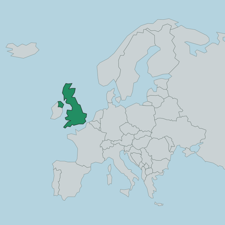
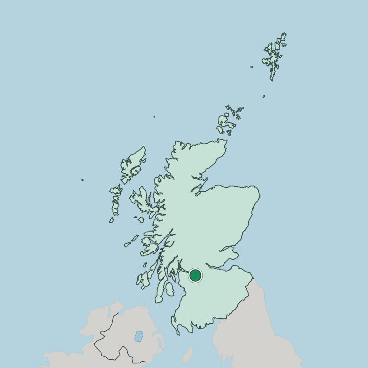
Glasgow stands on the banks of the River Clyde in west central Scotland, at the heart of the Central Belt. The river runs west through the city toward the sea, and the ground rises into low hills on either side. Sandstone terraces climb those slopes.

The centre sits on the north bank. Beyond the built-up core, the Clyde opens out toward the firth and the western coast of Scotland.

What is the climate of Glasgow?

Glasgow has a mild, wet climate shaped by the Atlantic weather that reaches west central Scotland. Rain falls through much of the year, and the grey, drizzly days the city calls dreich are a familiar part of its character along the River Clyde. Clouds hang low.

When the sun does break through, the deep-red sandstone of the terraces glows warm across the Central Belt. Snow is uncommon in the valley, though it dusts the surrounding hills in winter.

How do you get to Glasgow?

Glasgow is the main transport hub of west central Scotland, tied into the rail and motorway network of the Central Belt. Trains run in from across Scotland and beyond, and its central stations sit within the core beside the River Clyde. Two mainline stations serve the city.

From there the Gallery of Modern Art and the shops lie a short walk away. The Clyde has drawn traffic to the city for centuries.

Good for

More cities in Scotland

Updated August 2026