Japan
Yamagata-ken, Japan — Towns & Travel Guide


Yamagata-ken is a mountainous prefecture on the Sea of Japan coast of northern Honshū, drained by the Mogami River and ringed by pilgrimage peaks.
About Yamagata-ken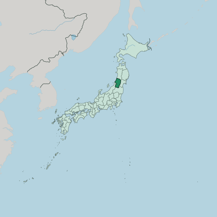


Towns & cities in Yamagata-ken
Pick a town or city — each links to where to stay.
Yamagata city makes the easiest base, set in the Murayama basin and reached directly by the Yamagata Shinkansen up from Tokyo. Rail access is the draw. Zaō Onsen sits high on the volcano's flank for skiers, while Ginzan Onsen keeps its Taishō-era ryokan along a narrow river deeper in the northern hills.
West on the Sea of Japan lie the Shōnai towns of Tsuruoka and Sakata, the staging ground for Dewa Sanzan pilgrims. Choose the capital for trains; choose the onsen valleys or the coast when you want mountains and sea.
About Yamagata-ken
What is Yamagata-ken known for?
Fruit made this prefecture's name. Yamagata-ken grows the bulk of Japan's cherries, and its orchards also turn out pears, grapes, and the prized Satō Nishiki cherries that growers here first raised. Yonezawa beef and buckwheat soba round out the table.
In winter the volcanic slopes of Mount Zaō fill with juhyō, the frost-caked conifers that skiers call snow monsters. The three peaks of the Dewa Sanzan still draw Shugendō pilgrims, and the mountainside halls of Yamadera reward the long stone climb.
Where is Yamagata-ken?
Yamagata-ken sits on the western side of the Tōhoku region, in the north of the island of Honshū. Its whole western edge fronts the Sea of Japan. Mountains wall in almost every other side. Akita Prefecture lies to the north, Miyagi Prefecture across the ridges to the east, Fukushima Prefecture to the south, and Niigata Prefecture down the coast to the south-west.
Forest covers most of the interior. Level ground is scarce, so towns crowd the river basins and the narrow coastal plain. The Mogami River organizes the whole prefecture.
It rises in the southern mountains, gathers the streams of the Yamagata and Yonezawa basins, and cuts north and then west through a gorge to reach the Sea of Japan at Sakata, where its delta forms the Shōnai plain. Volcanoes mark the borders. Mount Chōkai stands over the coast in the north-west on the line with Akita, and Mount Zaō rises in the south-east on the line with Miyagi.
Between them lie the three peaks of the Dewa Sanzan, Haguro, Gassan, and Yudono. Custom divides the land into four regions: Murayama and Mogami inland along the river, Okitama in the southern basins, and Shōnai on the coast.
What is Yamagata-ken like?
Mountain worship runs deep here. For centuries yamabushi ascetics of the Shugendō tradition have walked the Dewa Sanzan, and the five-storey pagoda at the foot of Mount Haguro stands among Japan's National Treasures. The poet Matsuo Bashō passed through on his northern journey, climbing the stone steps of Yamadera and writing there his famous verse on cicadas and silence.
That pilgrim geography still shapes how the prefecture sees itself. Faith, mountains, and craft sit close together. Food carries the rest of the identity.
The cool basins yield cherries, Yonezawa beef, and the Tsuyahime rice that feeds a wide field of sake breweries, while cold mountain water and buckwheat make Yamagata's soba. In autumn, riverbanks fill with imoni, the taro-and-beef hotpot cooked over open fires by whole neighbourhoods. Summer brings the Hanagasa Festival to the capital, where dancers spin flower-decked straw hats through the streets of Yamagata.
Hot-spring bathing threads through the year, from the sulphur pools of Zaō Onsen to the lamplit river of Ginzan Onsen. Older still is the trade in benibana safflower, once gathered from the summer fields and shipped down the Mogami River to colour the silks and lip rouge of distant Kyoto. The everyday language is Japanese.
What is the history of Yamagata-ken?
This land was long the southern half of Dewa Province. The warlord Mogami Yoshiaki raised Yamagata Castle over the Murayama basin and pushed his domain to its greatest reach before the Tokugawa shoguns broke it apart. Trade did the rest.
Down on the coast, Sakata prospered as a Kitamae-bune port, sending the region's rice and benibana safflower by sea toward Kyoto and Osaka. The modern prefecture was assembled in 1876, when several smaller units merged under Yamagata as their capital.
What is the climate of Yamagata-ken?
Yamagata-ken sits deep in snow country. Wet winds off the Sea of Japan pile heavy snow across the mountains and inland basins through the long winter, feeding the ski runs and the juhyō frost trees of Mount Zaō. Summers swing the other way.
Ringed by peaks, the Yamagata Basin traps heat until the air turns fiercely humid, and the valley once logged one of the hottest days ever measured in Japan. Spring and autumn are short, bright, and welcome.
How do you get to Yamagata-ken?
Most visitors ride the rails in. The Yamagata Shinkansen runs straight from Tokyo up through Fukushima to Yamagata city and on to Shinjō, and frequent highway buses cross from Sendai in neighbouring Miyagi over the mountains. Two airports back up the trains.
Yamagata Airport serves the inland basins, and Shōnai Airport lands flights near Sakata and Tsuruoka on the Sea of Japan side. From there, buses climb to the onsen towns and the mountain trailheads.
Good for
Updated July 2026