Japan
Shiga, Japan — Towns & Travel Guide


Shiga is an inland prefecture in Japan's Kansai region, wrapped around Lake Biwa, the country's largest freshwater lake, east of Kyoto.
About Shiga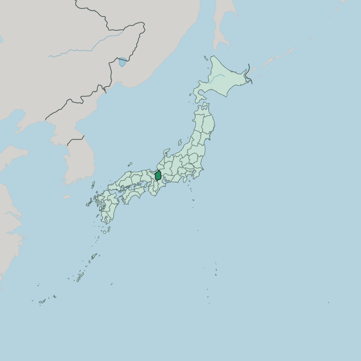


Towns & cities in Shiga
Pick a town or city — each links to where to stay.
Ōtsu holds most of the beds. The prefectural capital sits at the southern tip of Lake Biwa, minutes from Kyoto by train, and it makes the easiest base for a first visit or a run of day trips around the water. The other towns ring the lake.
Hikone anchors the eastern shore beneath its castle, Nagahama guards the northern end with its glassware quarter at Kurokabe, and Ōmihachiman keeps a merchant canal district south of them. Kusatsu holds the south-eastern approaches, the old junction of the Tōkaidō and Nakasendō highways.
About Shiga
Lake Biwa defines Shiga.
What is Shiga known for?
The largest freshwater lake in Japan fills the centre of the prefecture, and the land, the towns, and the rail lines all arrange themselves around its shore. Hikone Castle stands on the eastern side, one of only twelve original keeps left in the country and one of five ranked as National Treasures. Enryaku-ji, the mountaintop headquarters of Tendai Buddhism, crowns Mount Hiei above the south-western shore.
Most visitors come from Kyoto, a short train ride to the west, drawn by the water, the castle, and the old merchant towns of the historic province of Ōmi.
Where is Shiga?
Shiga is an inland prefecture in the Kansai region, one of Japan's eight landlocked prefectures. Lake Biwa sits at its heart. The largest freshwater lake in Japan spreads across the middle of the prefecture and fills close to a sixth of its whole area, so the land is really a ring of shore, plain, and mountain wrapped around open water.
Mountains close off almost every edge. The Hira Mountains and Mount Hiei wall the western side above Ōtsu, the Ibuki Mountains rise along the north-east, and the Suzuka Mountains divide the south-east from Mie. Rivers run down from all of them into the lake.
Only one river runs out. The Seta River drains the southern end of Lake Biwa and flows on toward Osaka as the Yodo River, the single natural outlet for a basin fed by more than a hundred streams. Shiga's land borders follow the mountains. Fukui lies to the north, Gifu to the north-east, Mie to the south-east, and Kyoto to the west beyond the Hira ridgeline.
The lake itself sorts the prefecture into four parts, the northern, western, eastern, and southern shores that locals name Kohoku, Kosei, Kotō, and Konan.
What is Shiga like?
Shiga trades on water and on merchants. The old province of Ōmi bred one of Japan's great merchant classes, the Ōmi shōnin, families who set out from lakeside towns like Ōmihachiman to build businesses across the whole country and carried home a code that a good deal must satisfy seller, buyer, and society alike. Their warehouses still line the canals.
Some grew into names known nationwide. The prefecture also carries a deep Buddhist heritage, centred on Enryaku-ji, the Tendai monastery on Mount Hiei whose monks shaped Japanese religion for centuries. Food here starts with the lake.
Fishermen still work Lake Biwa for its own species, and the prefecture guards funazushi, fermented crucian carp packed in rice that counts among the oldest ancestors of sushi. Ōmi beef comes off the same fertile plain, one of the country's oldest wagyu lines. Japanese is the language. Castle towns such as Hikone hold onto their samurai past in stone walls, tea gardens, and a mascot named Hikonyan who never leaves, while the lake festivals and the fireworks over the water mark the working calendar of the shore.
What is the history of Shiga?
Shiga was once Ōmi. The province lay on the roads between the imperial capitals and the country's east, astride both the Tōkaidō and the Nakasendō, which made its lakeshore plain fought-over ground for centuries. Emperor Tenji moved the imperial court to Ōtsu for a few years in the seventh century.
Oda Nobunaga raised his Azuchi Castle over the eastern shore. After the battle at Sekigahara, the Ii lords took Hikone and finished its castle keep in 1622. The prefecture formed in 1872 and reached its present borders in 1881, when the Tsuruga region to the north passed to Fukui.
What is the climate of Shiga?
Shiga runs cold in the north and mild in the south. Winter winds off the Sea of Japan pile heavy snow onto the northern shore around Nagahama and onto Mount Ibuki, which has caught some of the deepest snowfalls ever measured in the country and keeps ski grounds busy through the season. The southern end near Ōtsu stays gentler, closer to the inland weather of Kyoto next door.
Lake Biwa softens both extremes. Summers turn hot and sticky after the June rains, but the water keeps a breeze on the shore.
How do you get to Shiga?
Most people reach Shiga through Kyoto. The prefectural capital, Ōtsu, sits only a few minutes down the line from Kyoto Station, and JR trains run on from there around the eastern shore of Lake Biwa to Hikone, Ōmihachiman, and Nagahama. Shiga keeps no airport of its own.
Long-distance travellers change at Maibara in the north, the junction of the Tōkaidō Shinkansen and the local lines, or come in from the airports at Osaka by way of Kyoto. Two rail lines trace the lake, one along each shore, so the water is never far from the platform.
Good for
Updated July 2026