Poland · Masovian Voivodeship
Where to Stay in Warsaw, Masovian Voivodeship


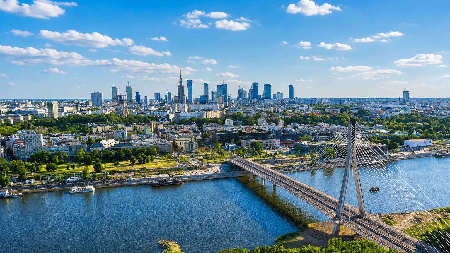
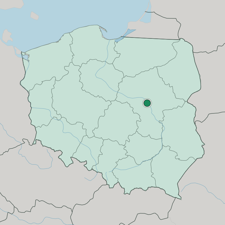
Warsaw stands on the Vistula in east-central Poland, the national capital, rebuilt around a restored Old Town and the Royal Castle.
Find your area →
Where to stay in Warsaw
The right area depends on your trip — here's what each neighbourhood is best for.

Wólka Węglowa
Wólka Węglowa is a Warsaw neighbourhood that the heritage registers leave almost blank, with no listed landmark to its name.Wólka Węglowa →
Młociny
Młociny is a district in Poland set out around two named structures: the Brühl Palace and the kościół NMP Królowej Polski.Młociny →
Mokotów
Apartment blocks give way to the wooded escarpment at Królikarnia in Mokotów, a district of Warsaw known for its embassies and its parkland.Mokotów →
Wola
Brick factory halls and glass towers line the same streets in Wola, a district of western Warsaw with Powązki Cemetery taking up its northern ground.Wola →
Żoliborz
Low villas and garden streets fill Żoliborz, a district of Warsaw on the left bank of the Vistula, laid out around Wilson Square north of the centre.Żoliborz →
Ursynów
Slab estates stand back from the Metro stations along aleja Komisji Edukacji Narodowej in Ursynów, a district of Warsaw that took its name from Pałac…Ursynów →
Białołeka
Białołęka is a district on Warsaw's northern edge, named for a white meadow on the Vistula and still low-built, its villa streets running off Modlińska…Białołeka →All neighbourhoods (60)

Bielany
Bielany is a district in north-western Warsaw, named for the white habits of the Camaldolese monks whose walled monastery still stands in Las Bielański.Bielany →
Śródmieście
Śródmieście is the central district of Warsaw, holding Warsaw Old Town, the Royal Castle in Warsaw and the Palace of Culture and Science.Śródmieście →
Wawer
Pine gardens and listed villas line the railway at Anin, in Wawer, a district in the south-eastern corner of Warsaw, bounded on the west by the Vistula.Wawer →
Kabaty
Kabaty is a high-rise residential neighbourhood in the Ursynów district of Warsaw, with its own station on the M1 line of the Warsaw Metro.Kabaty →
Żerań
Żerań is a northern suburb of Warsaw in the Białołęka district, where the Vistula bank carries the Żerań Power Station.Żerań →
Wyczółki
Wyczółki mixes housing with offices and warehouses in Warsaw's Ursynów district, and the grandstands of the Zespół Torów Wyścigów Konnych stand here.Wyczółki →
Wierzbno
Wierzbno fills the northwestern corner of Mokotów, a Warsaw neighbourhood of apartment estates, tenements, and the Dreszer Park.Wierzbno →
Wawrzyszew
Wawrzyszew is a Warsaw neighbourhood inside the district of Bielany, listed in the city's own City Information System.Wawrzyszew →
Służew
Służew straddles the boundary of Mokotów and Ursynów in Warsaw, a residential area with two universities, two old forts and its own metro station.Służew →
Siekierki
Siekierki is a low-rise Warsaw neighbourhood in the Mokotów district, where the Space Research Centre of the Polish Academy of Sciences stands.Siekierki →
Pyry
Pyry is a single-family housing area of Warsaw in the Ursynów district, with the Saints Peter and Paul church standing on Puławska Street.Pyry →
Placówka
Placówka is a named neighbourhood of Mokotów in Poland, with the Saint Ignatius of Loyola church at Wólka Węglowa as its one landmark.Placówka →
Odolany
Odolany is a neighbourhood of Warsaw inside the Wola district, marked by railway workshops, two Mariavite churches and the Cmentarz Wolski.Odolany →
Nowodwory
Nowodwory is a Warsaw neighbourhood with three listed names to its record: a parish church, a monument, and willa Topolanka.Nowodwory →
Muranów
Muranów is a neighbourhood of central Warsaw whose name comes from the palace of Simone Giuseppe Belotti, a Venetian architect from Murano.Muranów →
Moczydło
Moczydło is a Warsaw neighbourhood along Górczewska Street, where the Józef Sowiński Monument stands among its listed landmarks.Moczydło →
Czerniaków
Czerniaków is a residential neighbourhood of Lower Mokotów in Warsaw, holding Czerniaków Lake, the Warsaw Uprising Mound and a church of 1693.Czerniaków →
Augustówka
Augustówka is a low-rise corner of Warsaw on the west bank of the Vistula, holding Czerniaków Lake and the Siekierki Cogeneration Plant.Augustówka →
Chomiczówka
Chomiczówka is a neighbourhood of the Bielany district in Warsaw, with Fort II Wawrzyszew and the Our Lady Help of Christians church on its record.Chomiczówka →
Sadyba
Sadyba is a residential neighbourhood in Warsaw's Mokotów district, holding Fort IX and the Museum of Polish Military Technology.Sadyba →
Stegny
Stegny is an apartment-estate neighbourhood of Lower Mokotów in Warsaw, with the demilitarised Fort Che and the Filmoteka Narodowa on its ground.Stegny →
Ksawerów
Ksawerów sets the office towers nicknamed Mordor beside two neoclassical houses of 1786 and 1840, in the Upper Mokotów half of the district.Ksawerów →
Wyględów
Wyględów is a Warsaw neighbourhood of apartment blocks holding Fort M, whose decommissioned fortifications carry shops and recreation instead.Wyględów →
Sielce
Sielce sits in Lower Mokotów, a Warsaw neighbourhood recorded as farmland in 1412 and taken into the city in 1916.Sielce →
Stary Mokotów
Stary Mokotów sits in the northwestern portion of Warsaw's Mokotów district, where the Szuster Palace stands among mid- and high-rise blocks.Stary Mokotów →
Czyste
Czyste is a Wola neighbourhood in Warsaw, edged by Wolska and Towarowa streets and closed in by railway lines on two sides.Czyste →
Mirów
Mirów is a central neighbourhood in the Wola district of Warsaw, where the Saint Charles Borromeo church carries the area's own name.Mirów →
Jeziorki Północne
Jeziorki Północne is a quiet run of single-family houses in the Ursynów district of Warsaw, part of the wider neighbourhood of Jeziorki.Jeziorki Północne →
Jeziorki Południowe
Jeziorki Południowe is half of Jeziorki, a low-rise part of Warsaw's Ursynów district whose village was founded in the 15th century.Jeziorki Południowe →
Natolin
Natolin is a high-rise neighbourhood in Warsaw's Ursynów district, served by its own M1 metro station and known for the Natolin Park just outside.Natolin →
Skarpa Powsińska
Skarpa Powsińska is an Ursynów neighbourhood in Warsaw holding the Polish Academy of Sciences Botanical Garden and the Powsin Culture Park.Skarpa Powsińska →
Stary Imielin
Stary Imielin, also called West Ursynów, is a high-rise part of Warsaw holding the Maria Skłodowska-Curie National Research Institute of Oncology.Stary Imielin →
Ursynów Centrum
Ursynów Centrum is the apartment-block core of Warsaw's Ursynów district, with Arena Ursynów and the Saint Thomas church in Warsaw inside it.Ursynów Centrum →
Ursynów Północny
Ursynów Północny is a high-rise quarter of Warsaw, its Jary and Stokłosy estates served by two stations on the M1 line of the Warsaw Metro.Ursynów Północny →
Stare Bielany
Stare Bielany is a Warsaw neighbourhood on the Bielany side, with the Hala AWF and the Gmach główny among its landmarks.Stare Bielany →
Wrzeciono
Wrzeciono is a Warsaw district laid out around the Camaldolese Church, whose numbered hermitage plots run through the ground beside it.Wrzeciono →
Radość
Radość is a single-family housing neighbourhood of Wawer in Warsaw, and its landmarks are houses on streets such as Panny Wodnej and Wilgi.Radość →
Międzylesie
Międzylesie is a district of Warsaw, known through the railway station that carries its name and a listed house standing on ulica Patriotów.Międzylesie →
Miedzeszyn
Miedzeszyn stood as a village in its own right until 1951, when it became a neighbourhood of Wawer inside Warsaw.Miedzeszyn →
Marysin Wawerski
Marysin Wawerski is a district of Wawer in Warsaw, holding a November Uprising monument, a Józef Piłsudski monument and the Felix of Cantalicia church.Marysin Wawerski →
Falenica
Falenica lies on the right bank of the Vistula, a wooded part of Wawer that Warsaw absorbed in 1951 after years as a summer-cottage village.Falenica →
Anin
Anin is a villa subdistrict of Wawer in Warsaw, built around named houses and a railway station that carries the district's own name.Anin →
Sady Żoliborskie
Sady Żoliborskie is a residential quarter of Żoliborz in Warsaw, built at medium to high density and listed as an area in its own right.Sady Żoliborskie →
Szczęśliwice
A Warsaw district, Szczęśliwice keeps Hala Mera, the Ordon Redoubt memorial and the Statue of Wojtek the Bear among its marked addresses.Szczęśliwice →
Służewiec
Służewiec is the office quarter of Mokotów, a high-rise stretch of Warsaw where Manhattan Place stands near the Warszawa Służewiec railway station.Służewiec →
Saska Kępa
Saska Kępa sits inside Warsaw's Praga Południe, a quarter of villas and semi-detached houses laid out beside Skaryszew Park.Saska Kępa →
Rakowiec
Rakowiec lies in the west-central part of Warsaw, an Ochota neighbourhood marked by the Kościół Opatrzności Bożej and a monument to a happy dog.Rakowiec →
Raków
Raków fills a residential corner of Warsaw's Włochy district, with Fort VI and the Centrum Łopuszańska 22 shopping mall inside its bounds.Raków →
Praga
Praga is the historic core of right-bank Warsaw, in Poland, first mentioned in 1432 and a separate chartered town until 1791.Praga →
Powiśle
Powiśle runs between the Vistula and the escarpment above it, the strip of Śródmieście holding the Copernicus Science Centre and Ostrogski Palace.Powiśle →
Grochów
Grochów fills a stretch of Praga-Południe in Warsaw, its record running from the Church of the Conversion of Saint Paul to the pomnik Grenadierów.Grochów →
Gocławek
Gocławek, an officially designated neighbourhood of Praga Południe in Warsaw, takes in Grochowska Street and the King Cross Praga shopping centre.Gocławek →
Gocław
Gocław, a subdistrict of Praga-Południe dating from 1977, sits in south-east Warsaw around the Church of the Holy Apostles John and Paul.Gocław →
Nowe Bródno
Nowe Bródno belongs to the Bródno neighbourhood of Targówek, a Warsaw borough on the eastern side of the Vistula.Nowe Bródno →
Chrzanów
Chrzanów is a residential neighbourhood of mid-rise blocks in the Bemowo district of Warsaw, and it shares its name with Fort IV Chrzanów.Chrzanów →About Warsaw
What is Warsaw known for?
Warsaw is known as the capital of Poland, the largest city of the country, on the Vistula in east-central Poland. The capital wears two faces. Its restored Old Town and the Royal Castle stand near the river, while the Palace of Culture and Science rises over the modern centre, marking a city rebuilt after the Second World War.
Warsaw is the seat of government.
What are the main landmarks in Warsaw?
Warsaw gathers its landmarks around the Old Town and along the Vistula. The great sights stand close. The Royal Castle and Sigismund's Column mark the edge of the Old Town, while the Palace of Culture and Science towers over the modern centre.
Two museums hold the city's memory. The Warsaw Uprising Museum and the Museum of the History of Polish Jews tell the hardest chapters of the capital, and Łazienki Palace sits in its park to the south.
What is the history of Warsaw?
Warsaw became the capital of Poland on the Vistula in east-central Poland, and grew around its Royal Castle. The court made the city. When the seat of the crown moved here, the town on the river spread out around the castle and the Old Town, rising as the political heart of Poland over the centuries that followed.
Palaces and churches lined Krakowskie Przedmieście as the capital grew. Warsaw held the centre of the country. The Second World War all but destroyed the city.
The damage was near total. Much of Warsaw was left in ruins, its Old Town, its churches, and the Royal Castle reduced to rubble, and the capital had to be rebuilt almost from nothing. The city came back stone by stone.
Rebuilt after the war, the Old Town of Warsaw was raised again to its old form on the Vistula, and the restored historic core stands once more at the heart of the Polish capital. The modern centre rose alongside it, and the Palace of Culture and Science came to stand over the rebuilt heart of Warsaw.
Where is Warsaw?
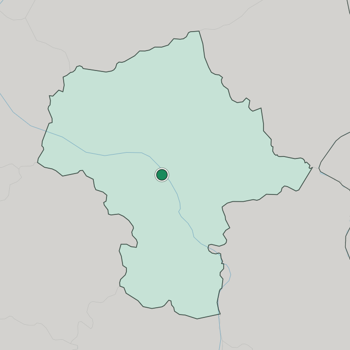
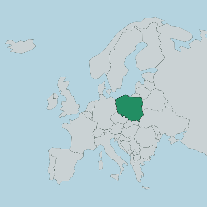
Warsaw lies on the Vistula in Masovian Voivodeship, in east-central Poland. The Vistula cuts straight through the middle of it. The capital spreads across both banks of the Vistula, its Old Town and centre on the western side and its outer districts reaching east over the river through the wider Masovian Voivodeship.
What is the climate of Warsaw?
Warsaw has a temperate climate with a continental edge, felt across east-central Poland. The seasons pull apart. Snow and hard frost grip the Vistula through the winter months, while summers turn warm over the capital, the open country around Warsaw giving the year its wide swing.
How do you get to Warsaw?
Warsaw is reached by air, by rail, and by road from across Poland. The lines converge on the capital. Trains run into the central stations, flights land on the edge of the city, and the main roads of east-central Poland gather on Warsaw, carrying travellers in toward the Vistula and the Old Town at the heart of Masovian Voivodeship.
Good for
More cities in Masovian Voivodeship
Updated September 2026