Japan
Tochigi, Japan — Towns & Travel Guide


Tochigi is an inland prefecture of Japan in northern Kantō, holding the Nikkō shrines, hot-spring towns and the plain north of Tokyo.
About Tochigi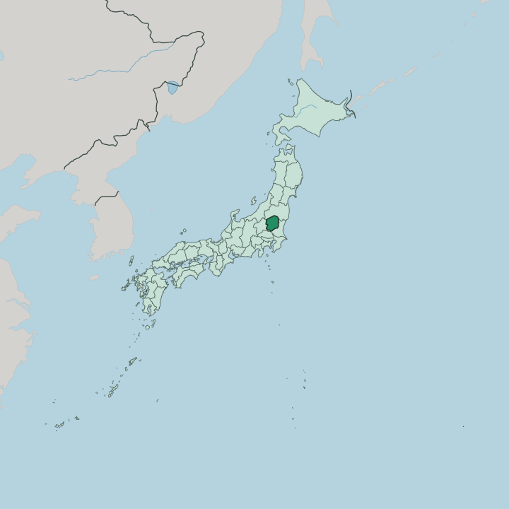


Towns & cities in Tochigi
Pick a town or city — each links to where to stay.
Most trips base themselves in Nikkō, at the foot of the shrines and the road up to Lake Chūzenji. Utsunomiya, the capital, is the rail hub and the easiest first night. Kinugawa Onsen fills a river gorge with ryokan.
Nasu spreads its inns across highland moor and volcano slopes in the far north, a cooler retreat where imperial villas and hot-spring resorts sit above the plain. Ashikaga anchors the south. Pick Nikkō for the sights and Utsunomiya for the trains.
About Tochigi
What is Tochigi known for?
Nikkō carries the prefecture's fame. Its shrines and temples, led by the Tōshō-gū mausoleum of Tokugawa Ieyasu, sit among cedar forests and rank on the UNESCO World Heritage list. Beyond them the land climbs to Kegon Falls and Lake Chūzenji below Mount Nantai.
Utsunomiya, the capital, is known across Japan for gyoza dumplings. The fields to the south grow more strawberries than any other part of the country, and the potters of Mashiko turn out the heavy folk ware that carries the town's name. Nasu adds highland hot springs to the list.
Where is Tochigi?
Tochigi sits inland in the north of the Kantō region, a landlocked prefecture on Honshu with no coast of its own. Fukushima lies over the northern mountains, Gunma to the west, Saitama to the south and Ibaraki to the south-east. The north and west rise into steep volcanic country. The peaks around Nikkō and the Nasu range wall off the prefecture, and the cone of Mount Nantai stands above Lake Chūzenji, the crater lake that feeds Kegon Falls.
Much of that high ground falls inside Nikkō National Park, a belt of forest, gorge and hot spring shared with the neighbouring prefectures. The land drops southward. Below the mountains opens the largest plain in the whole Kantō region, a broad farmed lowland that runs down toward Tokyo.
Three rivers drain it. The Kinugawa cuts its gorge past the onsen towns, the Watarase runs along the south-western edge near Ashikaga, and the Naka gathers the eastern slopes, all of them working south and east toward the Pacific Ocean. Utsunomiya, Oyama and the other cities cluster on this plain, where the flat ground and the rivers made room to build.
Tochigi is mountain in the north and field in the south.
What is Tochigi like?
The prefecture's culture leans on Nikkō and the crafts of the plain. The Tōshō-gū draws carvers' pilgrims as much as worshippers, its gates worked with painted dragons, the three wise monkeys and the sleeping cat that generations of Japanese schoolchildren know by heart. Faith and forest run together here.
Mashiko keeps a quieter fame. Its thick, earth-glazed pottery became a banner of the mingei folk-craft movement under the potter Hamada Shōji, and the town still fires kilns for buyers from across Japan. Utsunomiya answers with food rather than clay, trading on the gyoza dumplings served at counters all over the capital.
The southern city of Ashikaga holds the Ashikaga Gakkō, counted as the oldest school in the country, and floods its flower park with wisteria each spring. Farmland ties it together. Tochigi calls itself a strawberry country, growing the plump Tochiotome berries that reach markets nationwide, and the language of all of it, shrine plaque and menu alike, is Japanese.
What is the history of Tochigi?
For most of its recorded past the region was Shimotsuke Province, the lower half of an older land the early court split along the Kinugawa. Its fortunes turned in 1617. That year the shrine of Nikkō Tōshō-gū rose to enshrine the shogun Tokugawa Ieyasu, and the old Edo road filled with pilgrims bound for his tomb.
The Ashikaga clan that founded the Muromachi shogunate took its name from the southern town. The modern prefecture came together in 1873 from the merger of two smaller ones, and the seat later settled at Utsunomiya.
What is the climate of Tochigi?
Tochigi runs to extremes between mountain and plain. Summers on the lowland are hot and sticky, and few places in Japan hear as much thunder as Utsunomiya, where afternoon storms pile up over the plain through the warm months. Winters flip the pattern.
The plain turns dry and bright under a hard wind off the northern ranges, while the high country around Nikkō and Nasu banks up snow and cold. The heights stay wintry long after the fields below have thawed.
How do you get to Tochigi?
Tochigi has no airport and no coast, so most visitors come overland from Tokyo. The Tōhoku Shinkansen makes it quick, stopping at Utsunomiya and again in the north at Nasushiobara within an hour or so of the capital. Nikkō sits on its own line.
Tōbu trains run there straight from Asakusa in Tokyo, and a branch of the national railway climbs up from Utsunomiya to the same station. Drivers follow the Tōhoku Expressway north through the plain. From the city the mountains and shrines are an easy day away.
Good for
Updated July 2026