United States · Ohio
Where to Stay in Cincinnati, Ohio


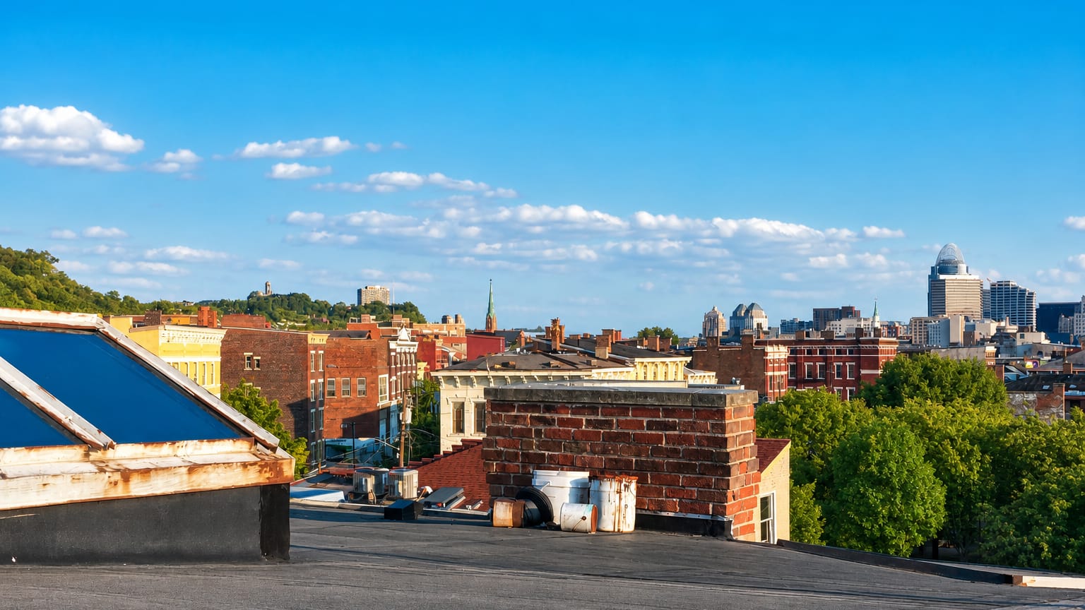
The Ohio River bends past Cincinnati, a hillside city in Ohio founded in 1788 and known for the Cincinnati Art Museum and its Union Terminal.
Find your area →
Where to stay in Cincinnati
The right area depends on your trip — here's what each neighbourhood is best for.

Over-the-Rhine
Over-the-Rhine, or OTR, is Cincinnati's largest historic district, holding Music Hall and Findlay Market inside the city's urban basin.Where to stay →
Downtown Cincinnati
Downtown Cincinnati is the central business district of Cincinnati, Ohio, and the neighbourhood that holds the Taft Museum of Art.Where to stay →
Hyde Park
Hyde Park was laid out as a retreat for Cincinnati's wealthy and stayed residential, with the shops of Hyde Park Square at its centre.Where to stay →
Avondale
Avondale is one of the 52 neighborhoods of Cincinnati, Ohio, and the ground the Cincinnati Zoo and Botanical Garden stands on.Where to stay →
West End
West End is one of the 52 neighborhoods of Cincinnati, Ohio, its residential grid largely cleared for Queensgate and the highway interchanges.Where to stay →
Mount Adams
Mount Adams is a hilltop neighborhood of Cincinnati, set east of downtown above the basin and south of Walnut Hills.Where to stay →
Price Hill
Price Hill is a region of three residential neighbourhoods west of central Cincinnati, settled early by Irish and German Catholic families.Where to stay →
Clifton
Gas lamps still burn on the side streets off Ludlow Avenue in Clifton, a neighborhood of Cincinnati, Ohio, on the hills above the Mill Creek valley.Where to stay →
Pleasant Ridge
Storefronts hold the corner of Montgomery Road and Ridge Avenue, the centre of Pleasant Ridge, a Cincinnati neighborhood named for its high ground.Where to stay →All neighbourhoods (58)

Walnut Hills
Walnut Hills rises on one of Cincinnati's oldest hilltops, a near east side neighborhood built around the streetcar crossing at Peebles' Corner.Where to stay →
Oakley
Oakley gathers along Madison Road at Oakley Square, a business district built around the park of Geier Esplanade in the eastern half of Cincinnati.Where to stay →
College Hill
Hamilton Avenue runs the length of College Hill, a hilltop neighborhood in northwestern Cincinnati named for two colleges that once stood here.Where to stay →
Mount Washington
A concrete water tower stands over Beechmont Avenue in Mount Washington, a hilltop neighborhood on Cincinnati's eastern edge, laid out as a village in…Where to stay →
Westwood
A stone church tower rises over Epworth Avenue in Westwood, the largest of Cincinnati's neighborhoods by area and a village in its own right until 1896.Where to stay →
The Banks
The Ohio River runs below The Banks, a riverfront quarter of Cincinnati laid out between Paycor Stadium and Great American Ball Park.Where to stay →
Northside
Brick storefronts line Hamilton Avenue through Northside, a Cincinnati neighborhood west of Mill Creek and known as Cumminsville into the 1980s.Where to stay →
Columbia-Tusculum
Painted Victorian fronts climb Tusculum Avenue in Columbia-Tusculum, the oldest neighborhood in Cincinnati, settled above the Ohio River in 1788.Where to stay →
East End
The steeple of St. Rose Church marks East End, a riverbank neighbourhood of Cincinnati strung along Riverside Drive under Columbia Parkway.Where to stay →
CUF
Hillside streets climb toward the WLWT TV Tower in CUF, the Cincinnati neighborhood of Clifton Heights, University Heights, and Fairview.Where to stay →
Madisonville
Italianate and Federal houses line Madison Road at Stewart Avenue, the old centre of Madisonville, a neighborhood of northeastern Cincinnati.Where to stay →
Camp Washington
The American Sign Museum lights old factory brick in Camp Washington, a Cincinnati neighborhood on the Mill Creek flats between the railroad and the hill.Where to stay →
Evanston
Limestone and glass block front the old bottling plant on Dana Avenue in Evanston, a Cincinnati neighborhood that reaches north to Xavier University.Where to stay →
Queensgate
Freight sheds line the Mill Creek flats at Queensgate, a warehouse district of Cincinnati, Ohio, built around the Art Deco hall of Cincinnati Union…Where to stay →
Mount Auburn Historic District
The Mount Auburn Historic District climbs a ridge above Cincinnati along both sides of Auburn Avenue, holding the William Howard Taft National Historic…Where to stay →
Mount Lookout
Delta Avenue climbs to the storefronts of Mt. Lookout Square in Mount Lookout, a neighborhood on Cincinnati's eastern hills that ends in Ault Park.Where to stay →
Pendleton
A gilded cross tops the tower of St. Paul Church in Pendleton, a triangular Cincinnati neighborhood between Liberty Street, Reading Road, and Sycamore…Where to stay →
Bond Hill
Tudor Revival cottages line Bella Vista Street in Bond Hill, a Cincinnati neighborhood laid out in 1870 as a railroad suburb and temperance community.Where to stay →
California
The Little Miami River ends its run at California, the southeastern-most neighborhood of Cincinnati, wooded above the waterworks on Kellogg Avenue.Where to stay →
Sayler Park
Barges work the channel below Gracely Drive in Sayler Park, the westernmost neighborhood of Cincinnati and a river village of its own until 1911.Where to stay →
Corryville
Marquee light spills onto Short Vine in Corryville, a hillside neighborhood of Cincinnati east of the University of Cincinnati, known for Bogart's.Where to stay →
Mount Airy
A castle-like water tower rises over Colerain Avenue in Mount Airy, a Cincinnati neighborhood holding Mount Airy Forest, the city's largest park.Where to stay →
North Fairmount
North Fairmount is a hillside neighborhood of Cincinnati, climbing west from the Mill Creek valley under the bell tower of St. Leo the Great.Where to stay →
Western Hills
Western Hills is the name Cincinnati's west side gives its own ridges above the Mill Creek valley, an idea rather than a mapped boundary.Where to stay →
East Walnut Hills
East Walnut Hills climbs the ridge east of downtown Cincinnati, gathered around DeSales Corner where Madison Road crosses Woodburn Avenue.Where to stay →
Sedamsville
Sedamsville lines the Ohio River below the Price Hill slope, a Cincinnati neighborhood settled in 1795 and largely inside two National Register districts.Where to stay →
English Woods
Cleared ground covers most of English Woods, a Cincinnati neighborhood above the Mill Creek where a 1940 housing project came down in 2005.Where to stay →
South Cumminsville
South Cumminsville is a Cincinnati neighborhood of frame houses west of the Mill Creek, strung along Beekman Street past the Wayne Playfield ballfields.Where to stay →
South Fairmount
Lick Run runs in daylight again through South Fairmount, a Cincinnati neighborhood held in one narrow valley along Queen City Avenue.Where to stay →
Carthage
Carthage is a Cincinnati neighbourhood in the Mill Creek valley, where Vine Street carries a Hispanic business district past the county fairgrounds.Where to stay →
North Avondale
North Avondale is one of Cincinnati's fifty-two neighbourhoods, holding Xavier University and the Avon Woods Preserve.Where to stay →
Roselawn
Braided challah came from refugee bakeries in Roselawn, a Cincinnati neighborhood annexed in 1905 and once the city's Jewish quarter.Where to stay →
Kennedy Heights
The seed merchant Lewis Kennedy platted Kennedy Heights in 1885, a hilltop Cincinnati neighborhood whose streets carry the names of English writers.Where to stay →
Laurel Homes Historic District
Laurel Homes was a Public Works Administration housing project in Cincinnati's West End, listed as a historic district in 1987.Where to stay →
Hartwell
Cincinnati stops at Hartwell, the city's northernmost neighborhood, where an 1868 plat broke from the grid into curves off Vine Street.Where to stay →
Spring Grove Village
Spring Grove Village took its name in 2007 from Spring Grove Cemetery, whose lawns and lakes fill the west of this Cincinnati neighborhood, once Winton…Where to stay →
Riverside
Riverside is a narrow industrial district of Cincinnati strung along the Ohio River, between Sedamsville and Sayler Park on the city's west side.Where to stay →
Lytle Park Historic District
Lytle Park Historic District covers fifty acres at the east end of downtown Cincinnati, laid around the park that gives it the name.Where to stay →
Linwood
Linwood is Cincinnati's eastern river corner, where Lunken Airport spreads over the flats and the Little Miami River closes the neighborhood in.Where to stay →
Lower Price Hill Historic District
Worker housing from the 1850s fills the Lower Price Hill Historic District, 196 contributing buildings on the valley floor west of Downtown Cincinnati.Where to stay →
Prospect Hill Historic District
Prospect Hill is a hillside district inside Mount Auburn in Cincinnati, known locally as Liberty Hill.Where to stay →
Millvale
Beekman Street climbs the Mill Creek valley through Millvale, a Cincinnati neighborhood built around the public townhomes that opened in 1954.Where to stay →
Paddock Hills
Paddock Hills is a residential neighborhood of Cincinnati, laid out in 1919 and noted for its Dutch Colonial Revival, Tudor Revival and bungalow houses.Where to stay →
West Fourth Street Historic District
Terra cotta and mansard brick face the West Fourth Street Historic District, four listed blocks of Cincinnati, Ohio, from Central Avenue to Vine Street.Where to stay →
East Westwood
Trees hold the ridge. East Westwood is a hillside neighborhood of Cincinnati, Ohio, with Goltra Preserve on its slope and Baltimore Avenue for a spine.Where to stay →
East Fourth Street Historic District
East Fourth Street Historic District is a three-building row of about 1860 at 123, 127 and 135-137 East Fourth Street in Cincinnati, Ohio.Where to stay →
Hoffner Historic District
Eleven buildings on one Northside block make up the Hoffner Historic District, five acres of Italianate brick on Hamilton Avenue in Cincinnati.Where to stay →
Eastwood Historic District
Eastwood Historic District loops maple-lined streets into a flattened hexagon between Oakley and Madisonville, Cincinnati, holding ten Sears kit houses.Where to stay →
Ninth Street Historic District
Brick and sandstone fronts line three blocks in the Ninth Street Historic District, 44 contributing buildings on the northern side of Downtown Cincinnati.Where to stay →About Cincinnati
Cincinnati is known for its river setting and its museums.
What is Cincinnati known for?
The hills hold the city. Rising in terraces from the north bank of the Ohio River, the old streets climb to the ridges above the water, where the Cincinnati Art Museum and the Taft Museum of Art keep the fine collections. The Cincinnati Museum Center at Union Terminal fills a great domed rail hall, and the National Underground Railroad Freedom Center stands on the waterfront.
Baseball and hills fill the rest of the name.
What are the main landmarks in Cincinnati?
The main landmarks of Cincinnati split between the river and the ridge. On the waterfront, the National Underground Railroad Freedom Center faces the Ohio River, while the great domed hall of the Cincinnati Museum Center at Union Terminal fills the West End above it in a single sweep of tile and stone. The Cincinnati Art Museum and the Taft Museum of Art hold the collections.
Old St. Mary's Church anchors the earliest streets.
What is the history of Cincinnati?
Cincinnati was settled in 1788 on the north bank of the Ohio River, first under the name Losantiville. The town sat at the confluence with the Licking River, and its landing grew into a steamboat port and a gateway for settlers heading down the great river. Wealth came fast with the trade.
Pork-packing and river commerce raised the early fortunes, and the Betts House survives from that first generation of building. The city became a haven on the free bank of the Ohio, and the National Underground Railroad Freedom Center marks that role on the waterfront where escaping people crossed from Kentucky. German and Irish families filled the hillside parishes, raising Old St. Mary's Church and St. Francis Xavier Church among many others.
Art and industry rose together: the Taft family gave its mansion as the Taft Museum of Art, the Cincinnati Art Museum climbed the eastern ridge, and the railroads built the grand hall that became the Cincinnati Museum Center at Union Terminal. From a river landing to Ohio's third city, Cincinnati grew upward from its water.
Where is Cincinnati?
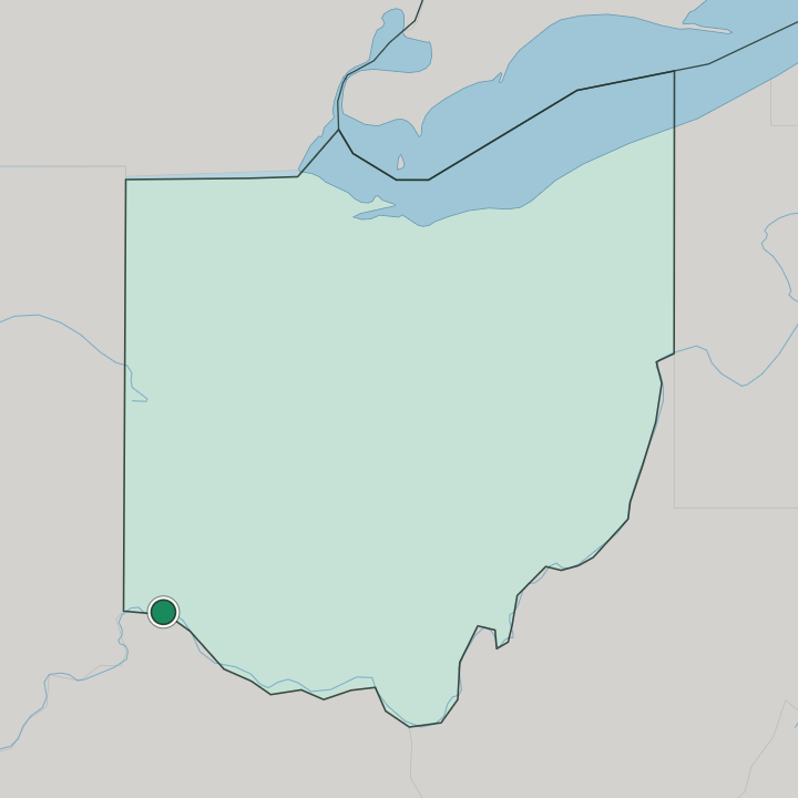
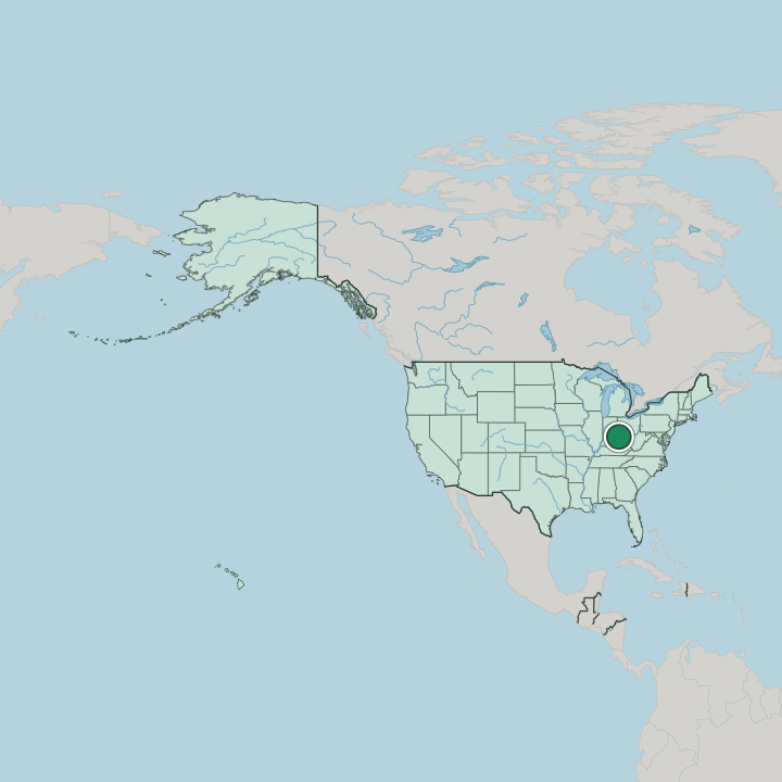
Cincinnati sits on the north bank of the Ohio River in Ohio, at the confluence with the Licking River. The land rises steeply from the water. Terraces and wooded hills climb from the riverside flats to the ridges, where the Cincinnati Art Museum crowns the eastern slope.
The Ohio River marks the state line with Kentucky across the stream.
What is the climate of Cincinnati?
Cincinnati has a temperate continental climate with four distinct seasons. Summers turn warm and humid in the river valley, and storms gather over the Ohio hills on the hottest afternoons. The Ohio Valley turns cold in winter.
Snow falls through the season, and spring and autumn bring the mild, changeable weather of the Ohio Valley between the two extremes.
How do you get to Cincinnati?
Cincinnati is reached by air, road, rail, and river. The main international airport lies across the Ohio River in Kentucky, and interstate highways bridge the water to link the city with the rest of Ohio. Trains still call at Union Terminal.
Barge traffic works the river below the hills, on the same water that carried the steamboats that built the town.
Good for
More cities in Ohio
Updated September 2026


